In November 2016, we travelled to Chile and Argentina to visit two of the world's last great frontiers — the majestic fjords and glaciers of Southern Patagonia (on a small ship) and the dramatic scenery of Torres del Paine National Park (hiking). Starting in Buenos Aires and ending in Santiago — plus a subsequent adventure to Easter Island — we discovered the remarkable diversity of South America.
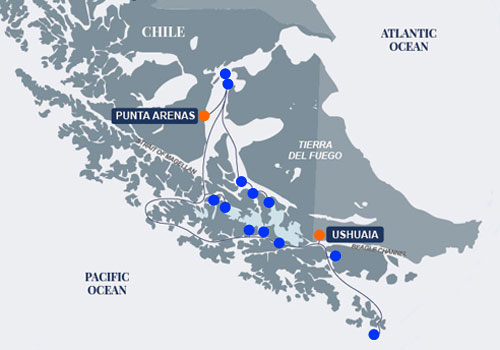
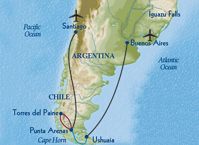
Our journey started with a few days in the capital city of Argentina located on the southeast coast of South America. From there Peter and I joined a small group of ten alumni from the University of Michigan. Together we flew south to Ushuaia to board a small ship which took us to Cape Horn, through Wulaia Bay and the Beagle Channel, and north through the Magellan Strait. We disembarked at Punta Arenas and travelled to Torres del Paine National Park and the Vincente Perez Rosales National Park via Puerto Montt. Peter and I left our group in Santiago and departed on our own to Easter Island.
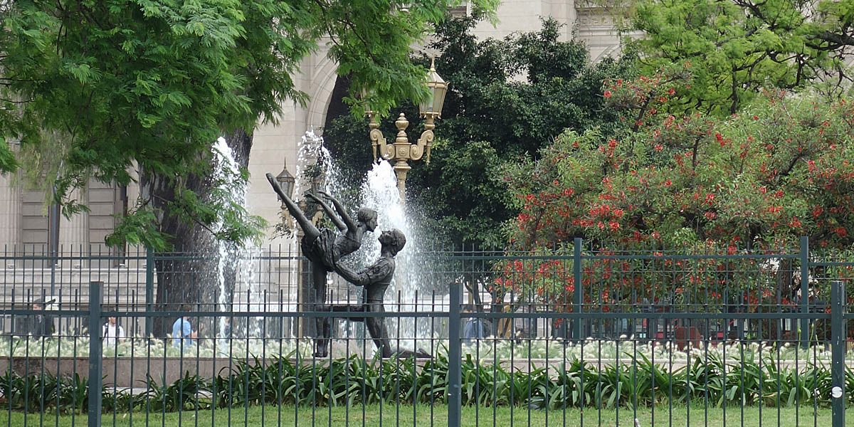
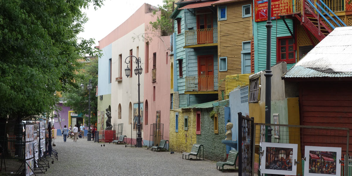
Tree-lined streetscape in Buenos Aires
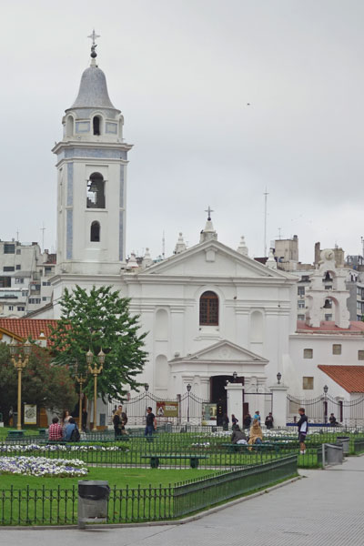
Starting Out in Buenos Aires
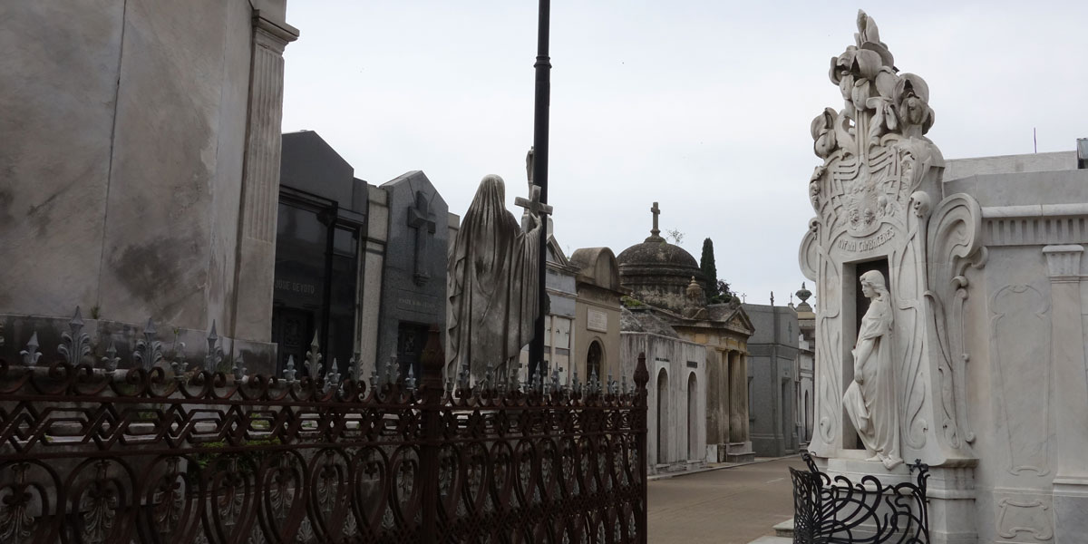
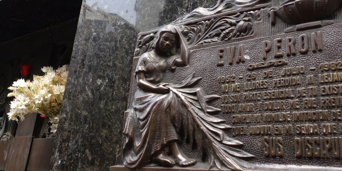
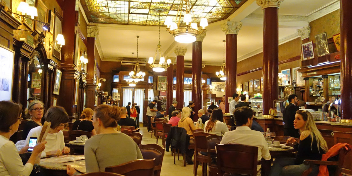
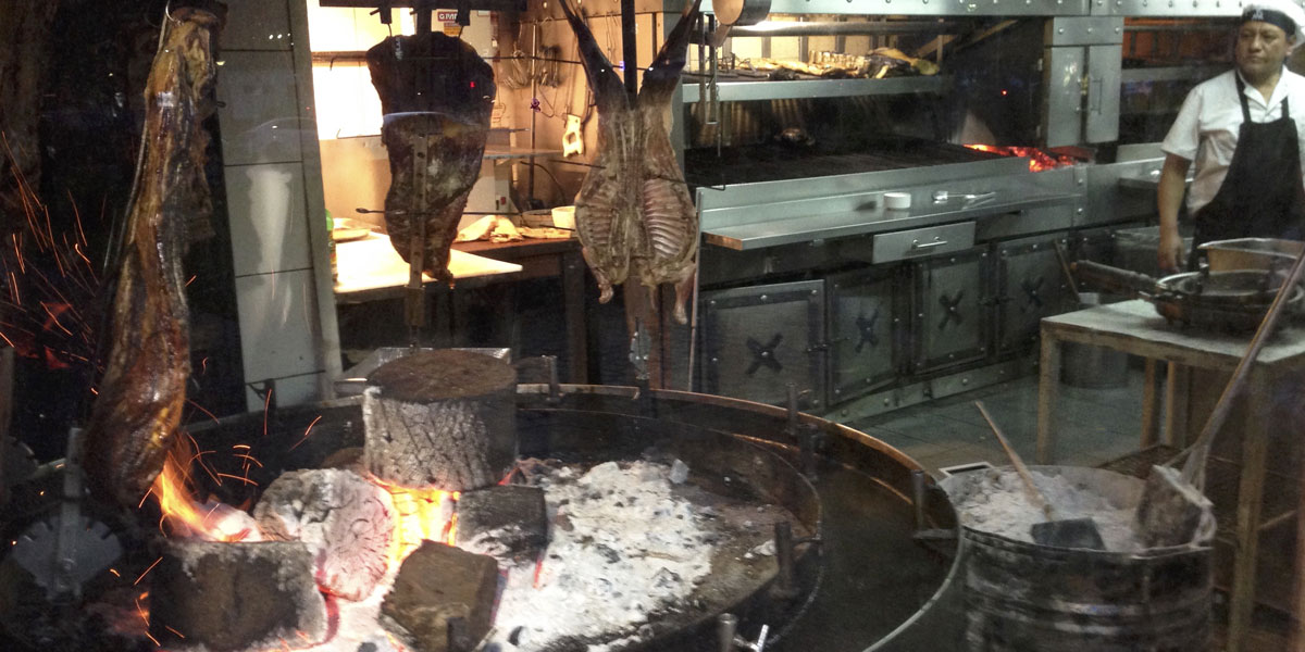
During our three days in this elegant capital city, we toured the lovely mansions and parks of the Polermo area, the colorful bohemian distinct of La Boca, and the Recoleta neighborhood with its famous Recoleta Cemetery (Eva Peron's resting place). We had lunch at the renowned Gran Cafe Tortoni (established in 1858) and dinner at a traditional Argentinian restaurant with meat roasting on an open fire at the entrance.
1 / 7
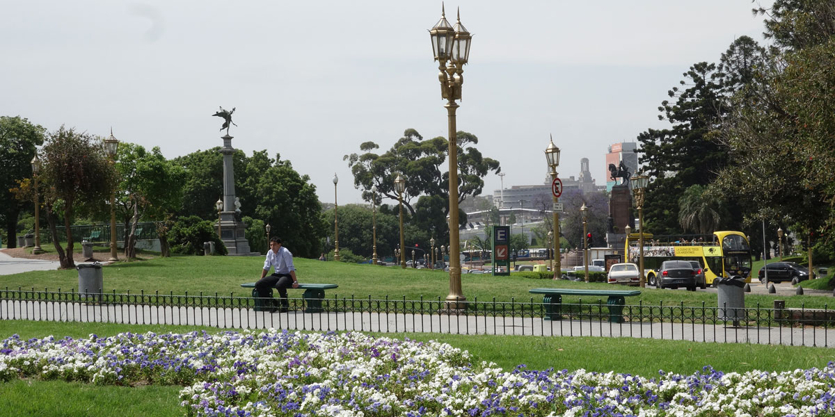
Park in the Recoleta neighborhood where our hotel was located
2 / 7
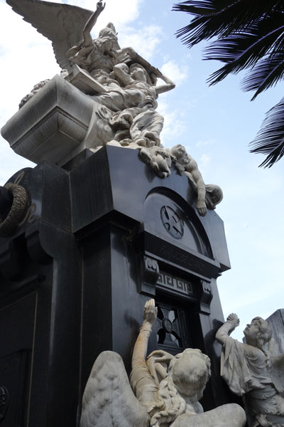
The famous Recoleta Cemetery
3 / 7
Eva Peron's resting place in the Duerte family crypt
4 / 7
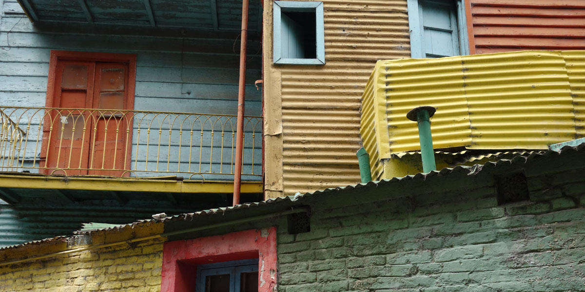
The artistic La Boca neighborhood
5 / 7
Colorful painted buildings in La Boca
6 / 7
Lunching inside the renowned Gran Cafe Tortoni
7 / 7
Meat roasting at the entrance of our barbecue restaurant
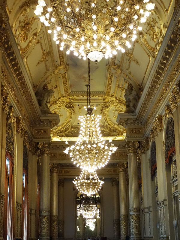
We also visited the Teatro Colon, one of the finest theatres in the world, renowned for its acoustics and architecture. It celebrated its 100th anniversary in 2008.
Main entrance hall of the Teatro Colon
Stained glass dome of the Teatro Colon
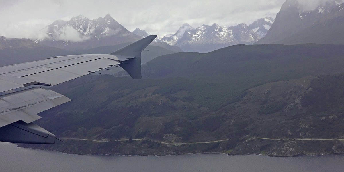
Flying towards Tierra del Fuego
The Tierra del Fuego National Park is a 155,676-acre nature reserve with Andes peaks, rivers, glacial lakes, and forests. In the lower elevations of the park, the forests are home to 20 species of terrestrial mammals, including the guanaco, Andean fox, North American beaver, European rabbit, muskrat, and 90 species of birds.
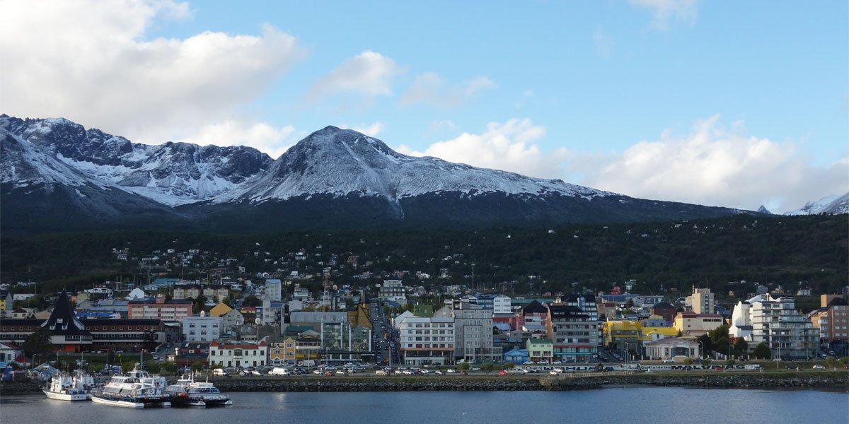
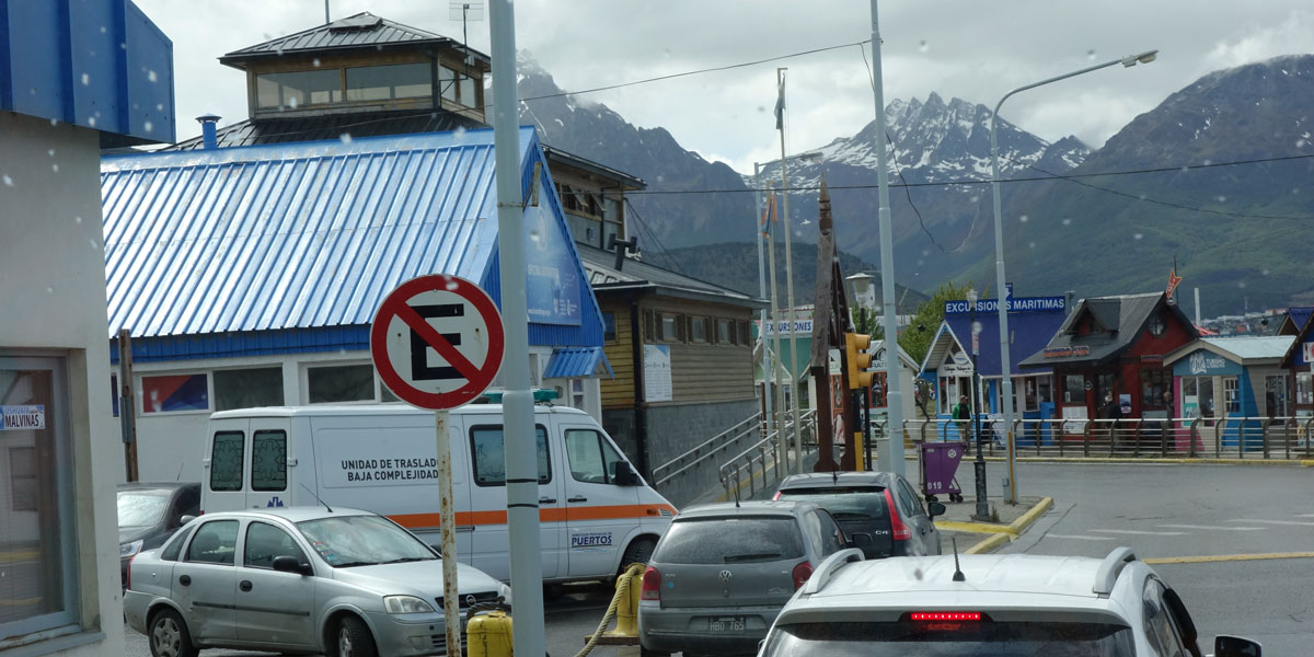
Ushuaia and the Tierra del Fuego National Park
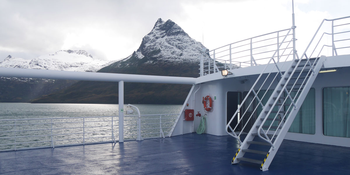
Very early in morning, we flew to Ushuaia — the world's southernmost city. I began my day with a hike in the Tierra del Fuego National Park. After lunch, we explored Ushuaia before boarding the M/V Stella Australis — our ship for the next several days. In the early evening, we set sail for Tierra del Fuego. This renowned archipelago is separated from the southern tip of South America by the Strait of Magellan — the important natural passage between the Atlantic and Pacific Oceans.
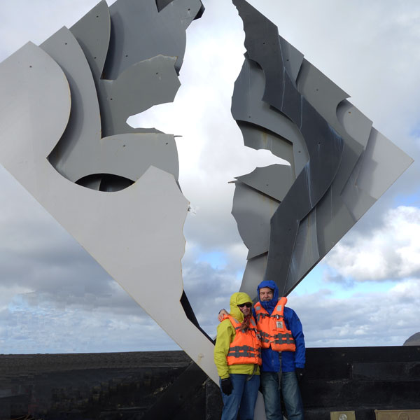
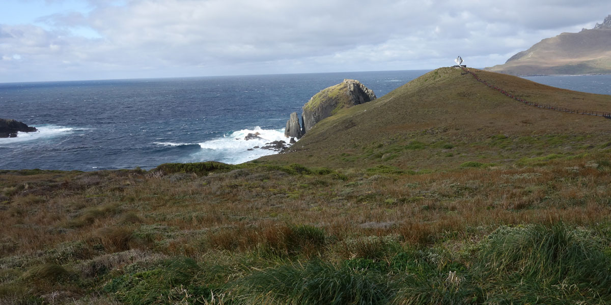
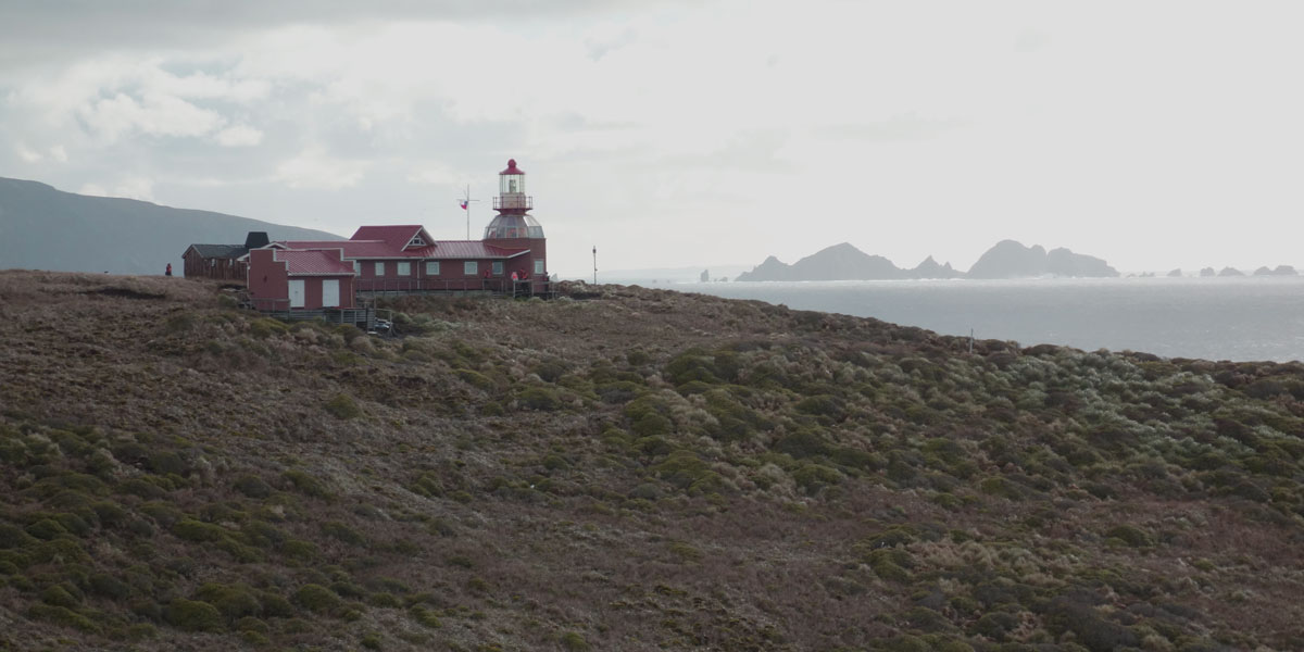
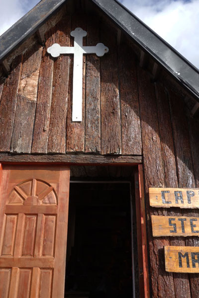
During the night, we crossed from Argentina into Chilean territorial waters via the Beagle Channel and Nassau Bay to Cape Horn. Cape Horn is located on Hornos Island in the Tierra del Fuego, where the Atlantic and Pacific Oceans meet. In the nineteenth century, clipper ships sailed around Cape Horn on their voyages between Europe and Asia. Frequent storms in the region caused many ships to sink and thousands to perish. The sheer promontory of Cape Horn rises some 1,400 feet above sea level. We disembarked our ship and went ashore via a Zodiac for a hike to the Cape Horn National Park and the monument at the top of the park. We also visited the tiny one-room Chapel of Stella Maris whose doors are left open to welcome visitors who want to pay respects to the sailors who lost their way or imagine the scene of past mariners who stopped in for a moment of prayer, thankfulness, or silence.
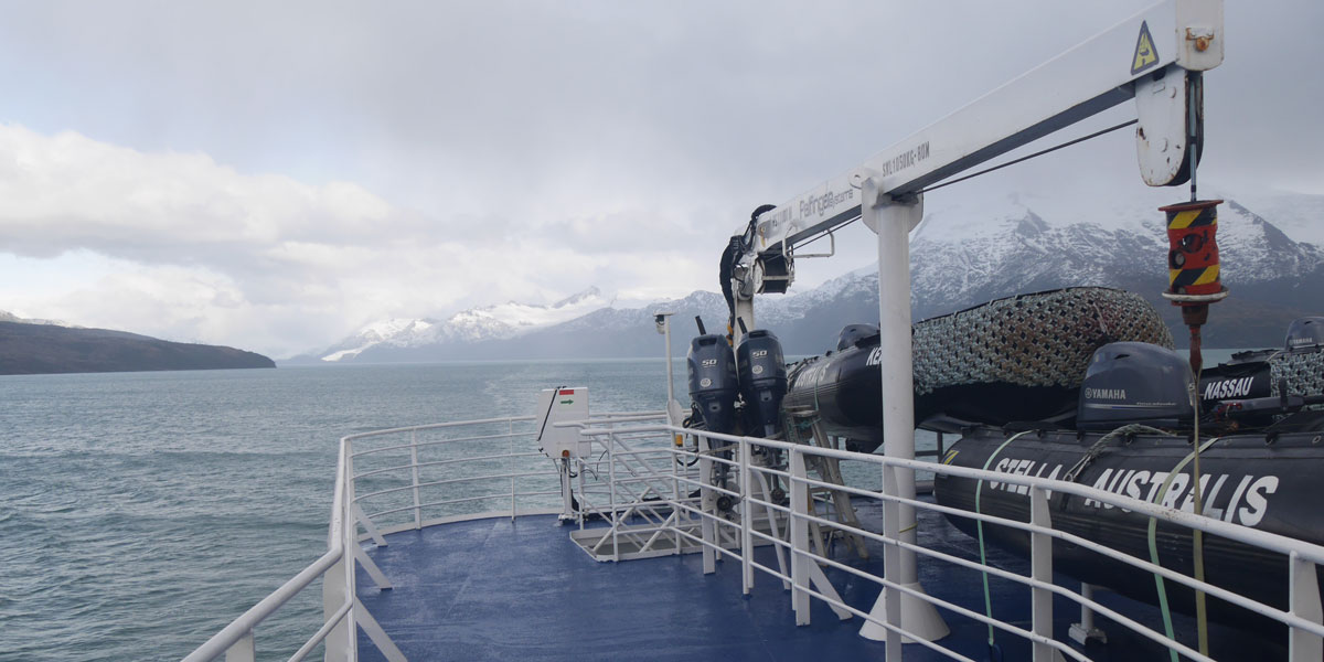
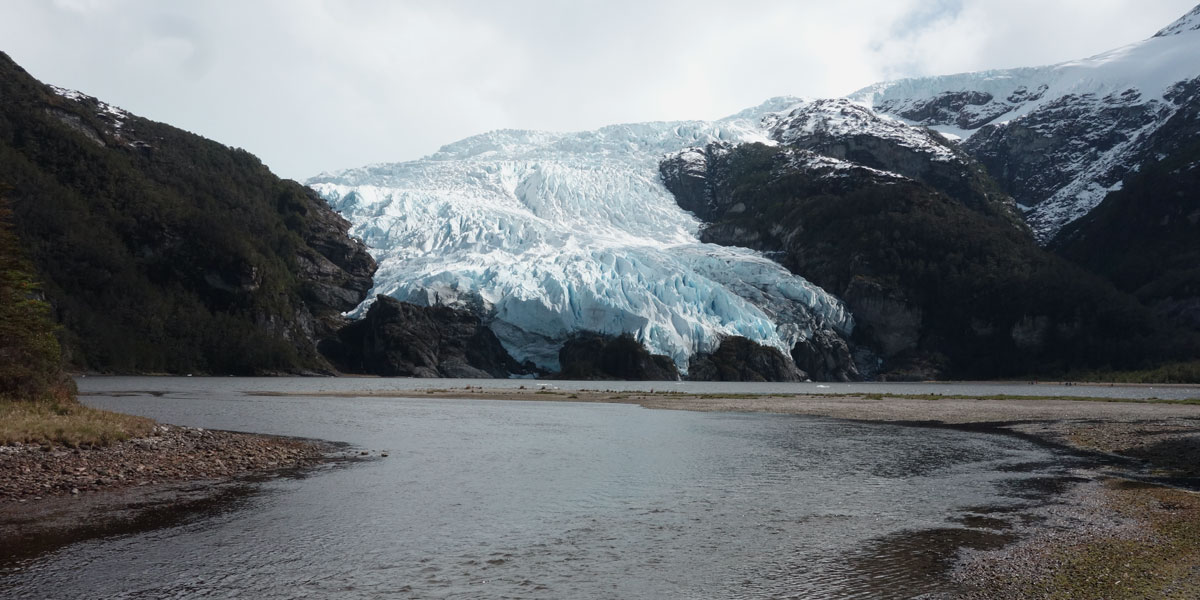
Scale of the Aguila Glacier (note the ship in the foreground)
Posing atop Hornos Island at the Cape Horn Monument
The Cape Horn Monument features an albatross in flight — the largest bird that is only seen in the southern ocean. The albatross is also the symbol of the Cape Horn Captains Brotherhood who sponsored its construction to honor the thousands of mariners who lost their lives in the waters around the Cape. This memorial, designed by a Chilean artist, is constructed of 22-feet-high steel plates and made to withstand winds of 200 miles per hour.
In the afternoon we sailed to Wulaia Bay with its sub-Antartic forests and multitude of land birds where Charles Darwin put to shore during his renowned expedition in 1833. We hiked along the shore of this sheltered bay before returning back to the ship.
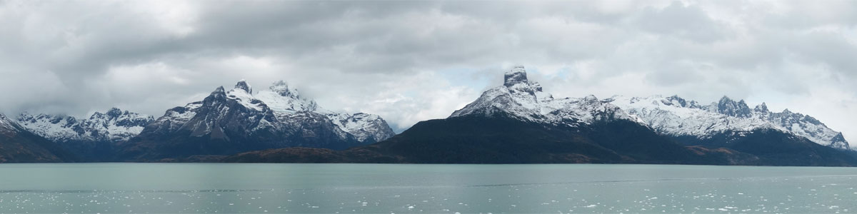
Panoramic view looking south from the Aguila Glacier
Cruising to the Aguila Glacier
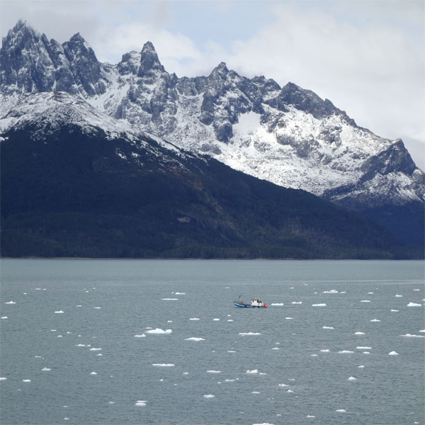
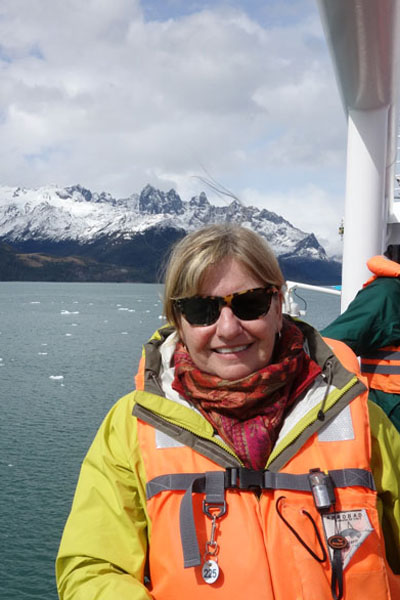
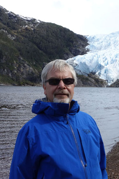
At night we sailed westward through the Beagle Channel into the Alberto de Agostini National Park, rounding the Brecknock Peninsula at the wester extreme of Tierra del Fuego. Our route took us through the Cockburn Channel, Magdalena Channel, and Keats Fjord to reach the scenic De Agostini Sound. Nestled in the heart of Tierra del Fuego's Darwin Cordilera mountain range, this fjord provides vistas of glaciers descending mountainside into the sea. We boarded Zodiacs for an afternoon excursion to the Aguila Glacier where we disembarked for a walk along the shore of a lagoon at the glacier's base.
1 / 8
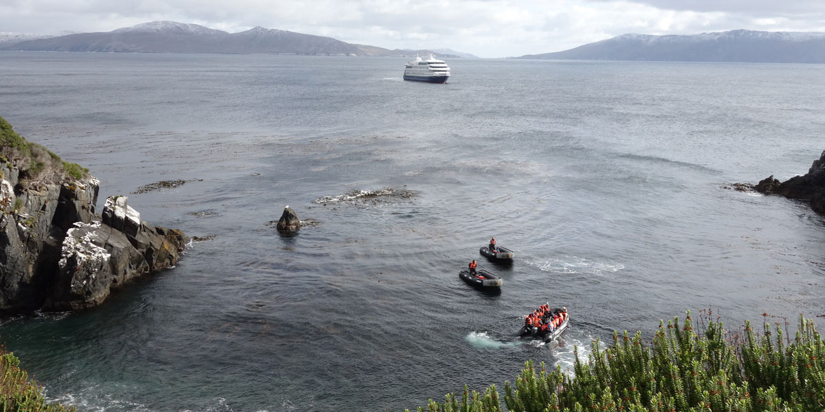
Starting our journey with the M/V Stella Australis
2 / 8
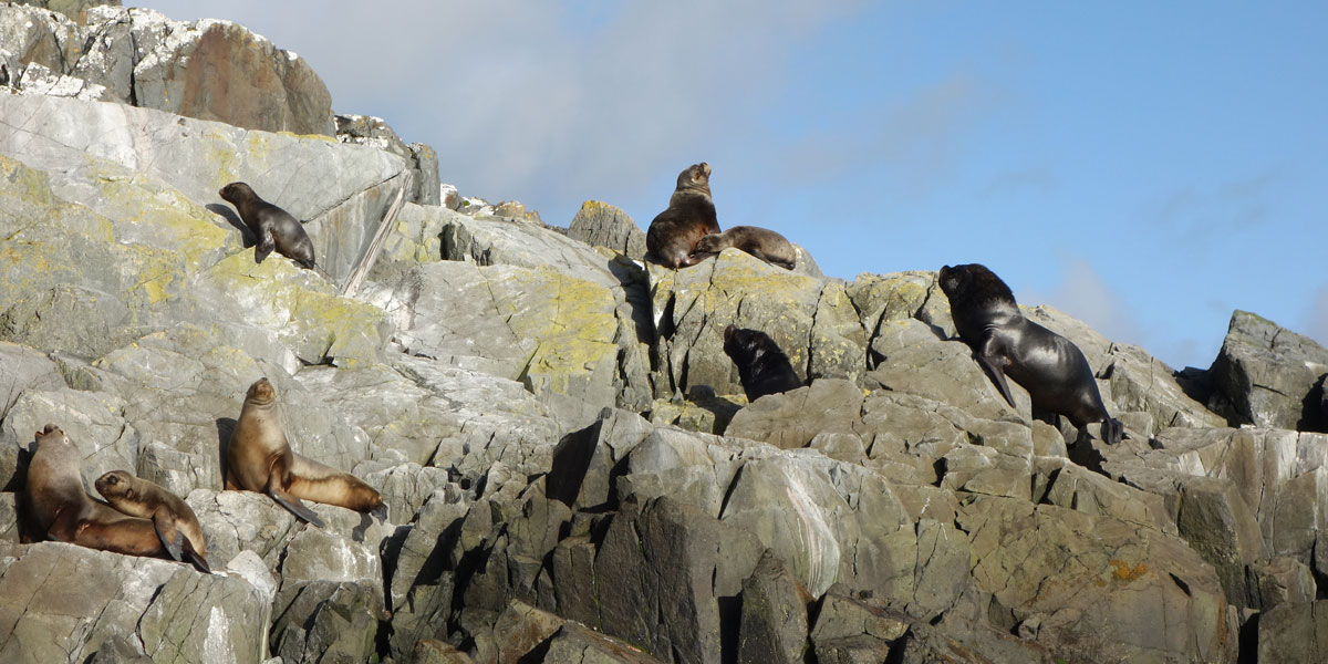
Seals sunning on the shore
3 / 8
Starting my climb to the monument at the top of Cape Horn National Park
4 / 8
The lighthouse at the Chilean Naval Station at Cape Horn
5 / 8
I head down to a Zodiac which will take me back to our ship
6 / 8
Approaching the Aguila Glacier
7 / 8
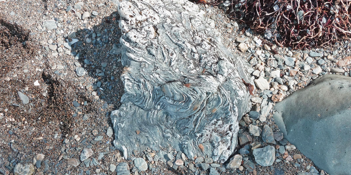
Contorted Gneiss — evidence of continental plates crushing
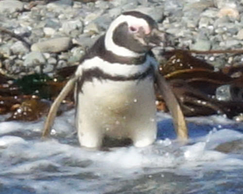
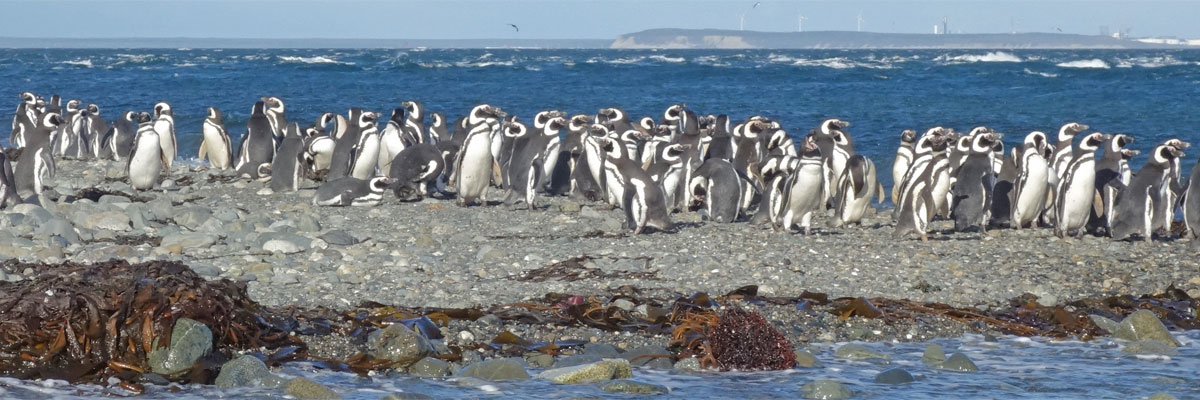
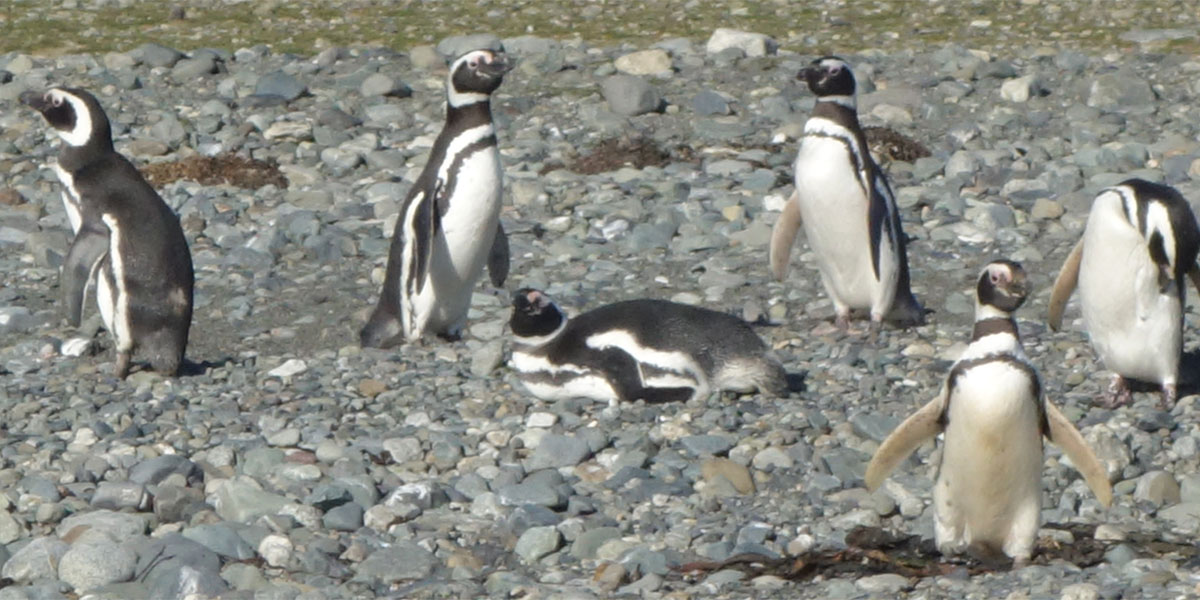
After an overnight cruise up the Magdalena Channel and back into the Strait of Magellan, we visited Magdalena Island. The entire island is part of Los Pinguinos Natural Monument (managed by the Chilean government) and home to an immense colony of more than 120,000 Magellanic penguins that coexist peacefully with cormorants, sea lions, and other species. We continue sailing in the late afternoon to Punta Arenas where we disembarked our ship.
Colony of 120,000 Magellanic penguins on Magdalena Island
Penguins on shore of Magdalena Island
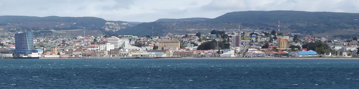
Panoramic view of Punta Arenas
Disembarking at Punta Arenas
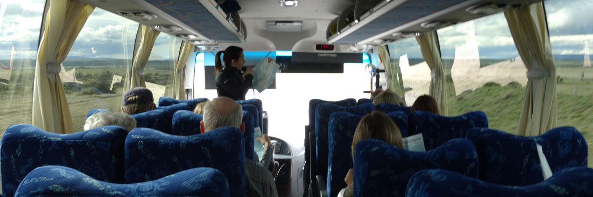
Punta Arenas is the capital city of Chile's southernmost Patagonia region. After lunch, we began a six-hour journey by bus across the classic Patagonia landscape to the Torres del Paine National Park.
Beginning our bus ride to Torres del Paine National Park
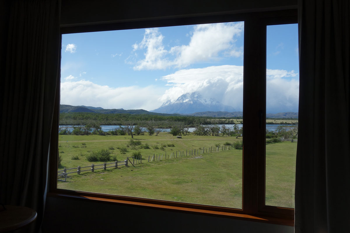
The view from my room
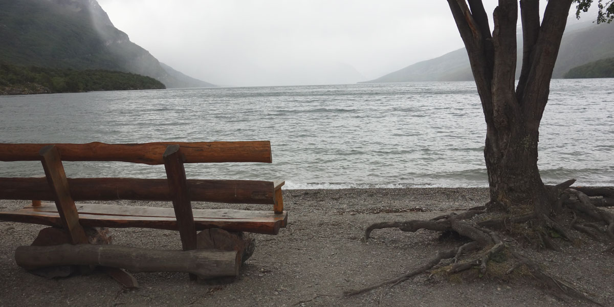
Torres del Paine National Park
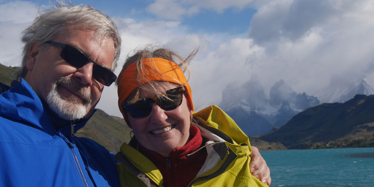
Arriving at the Torres del Paine National Park, we checked into a beautiful lodge with indigenous furnishings and designed to blend into its landscape. It was situated in a beautiful valley and our room had an amazing view of the mountains.
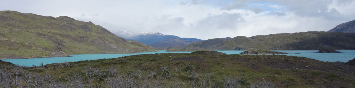
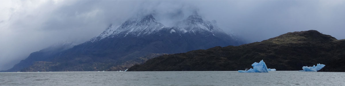
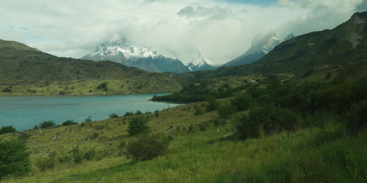
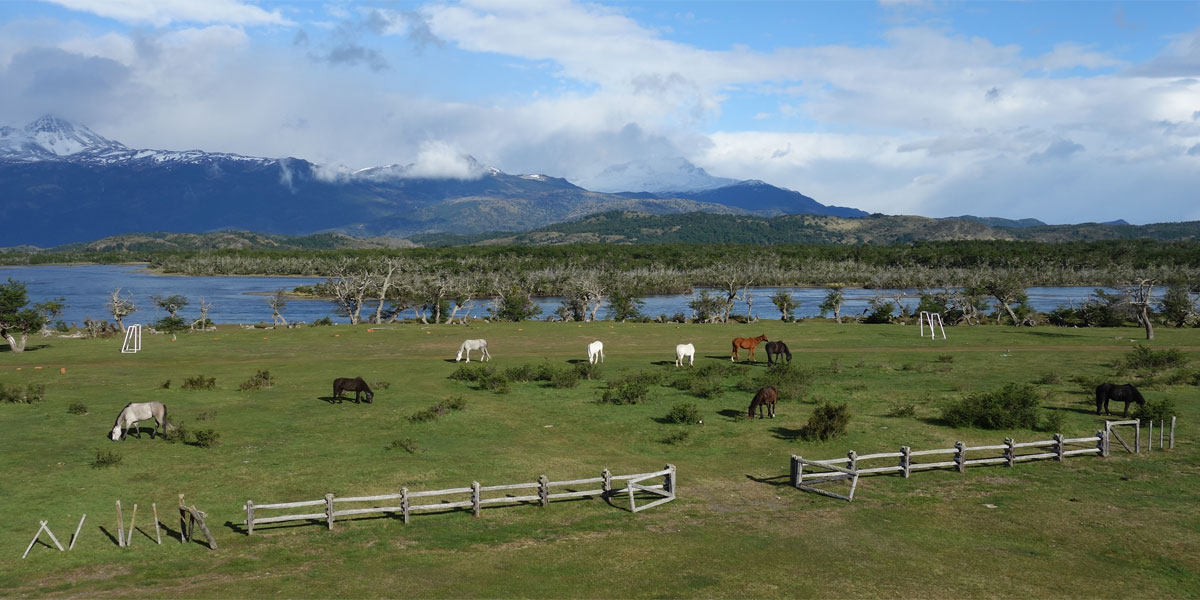
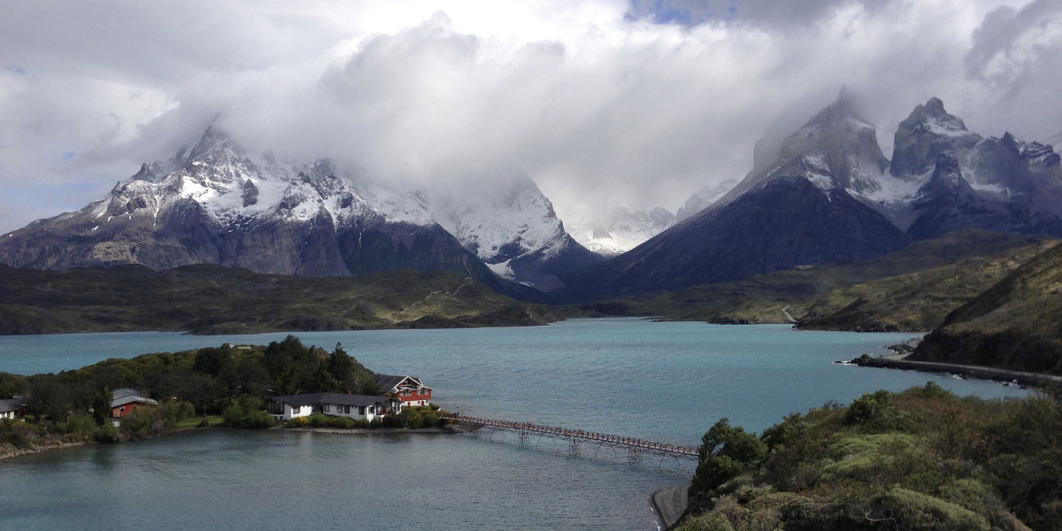
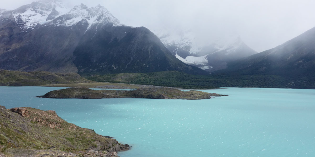
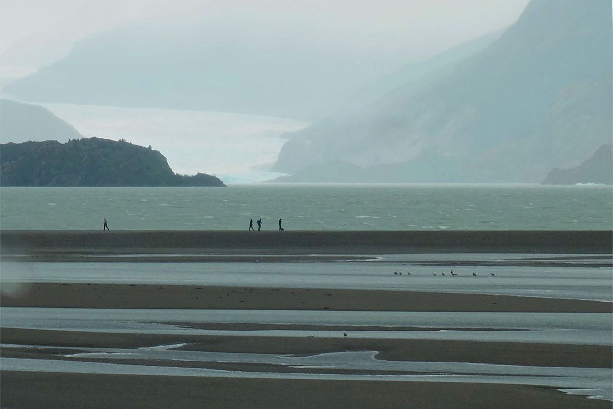
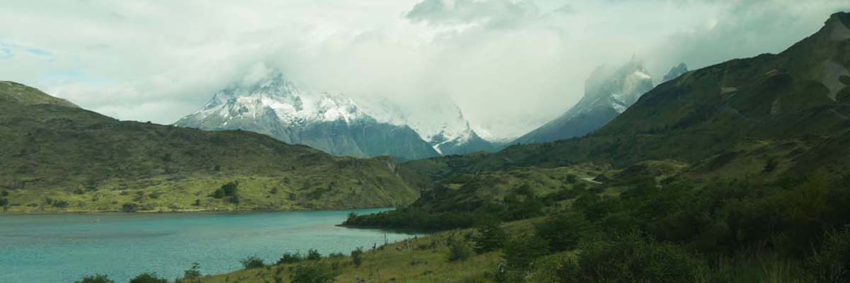
The Torres del Paine National Park is 700-miles square and encompasses mountains, glaciers, lakes, and rivers in Chile’s southern Patagonia region. Some of its most iconic sites are the three distinctive granite towers of the Paine mountain range — from which the park takes its name — and the horn-shaped peaks called Cuernos del Paine. The granite towers extend up to 8,200 feet above sea level and are joined by the Cuernos del Paine. The glaciers, including Grey, Pingo and Tyndall, belong to the Southern Patagonia Ice Field.
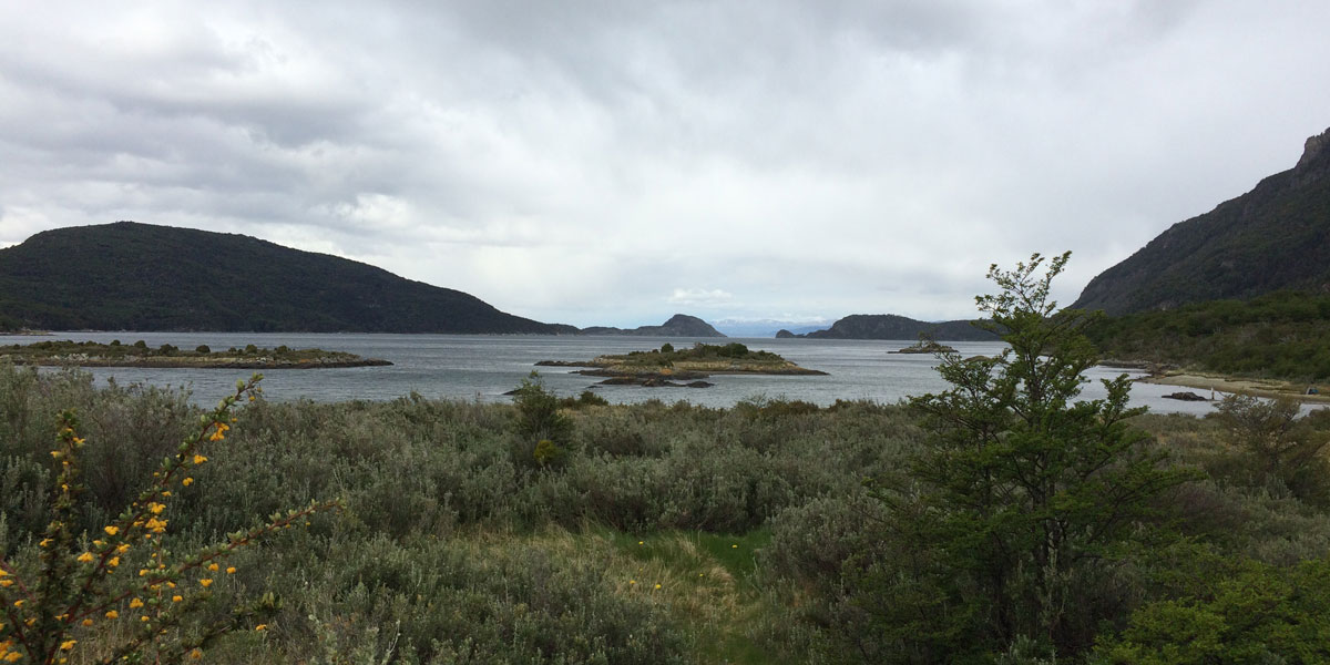
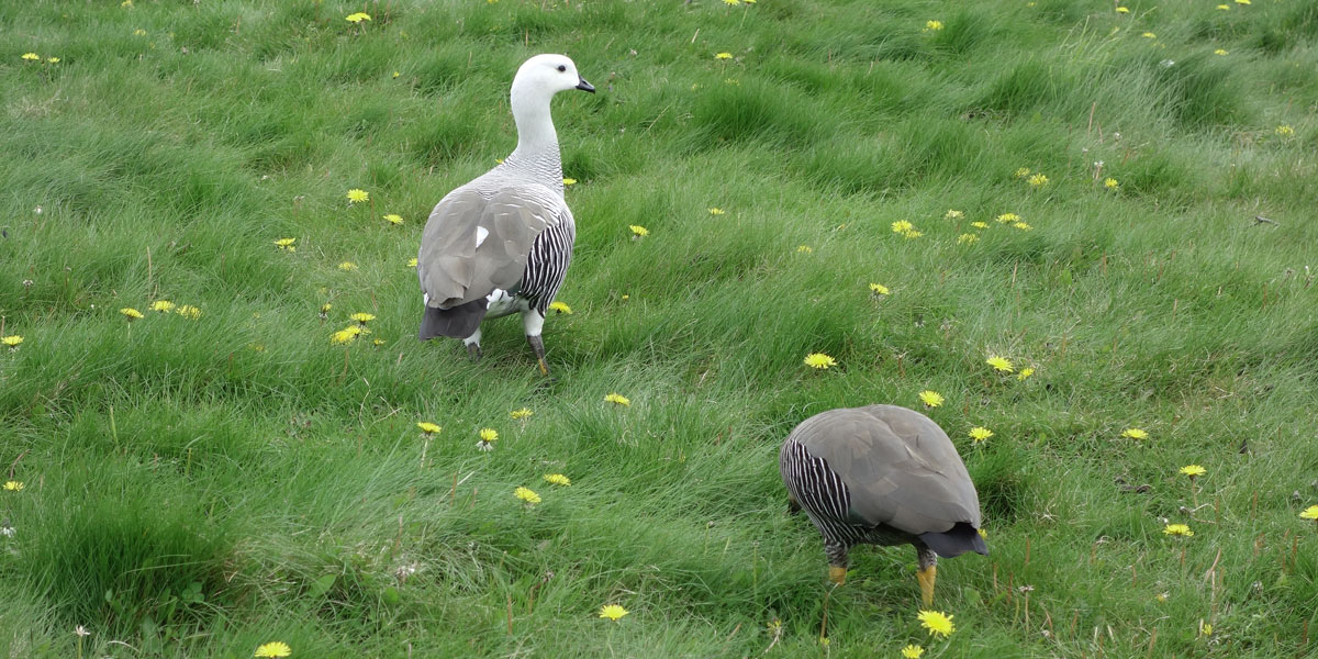
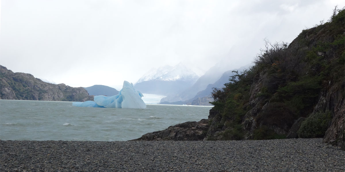
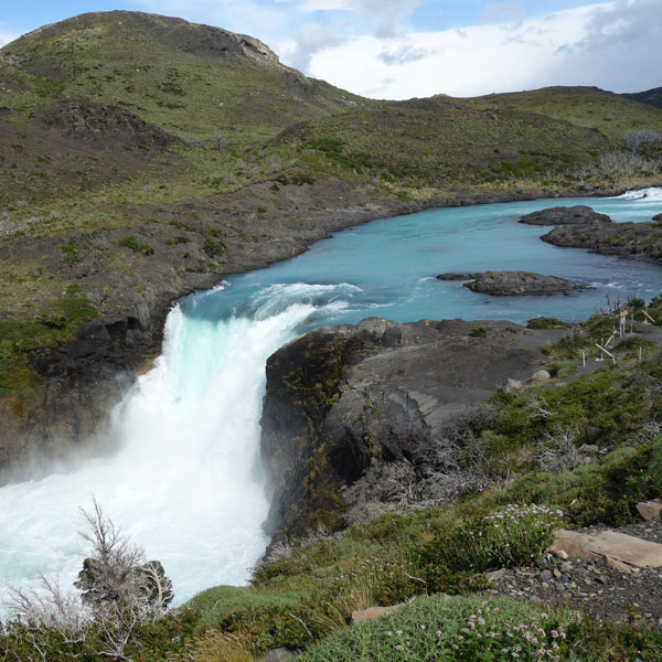
Over the next several days we explored this breathtaking park — a UNESCO World Biosphere Reserve of ancient glaciers, jagged granite mountain peaks, exquisite turquoise lakes, rushing rivers, and thundering waterfalls along with distinctive flora and fauna. We first visited the southern ice field of Lago Nordenskjold; Salto Grande with its rushing waterfall; Mirador Los Cuernos; and Lago Grey, the site of the colossal Grey Glacier.
Panoramic views in Torres del Paine National Park
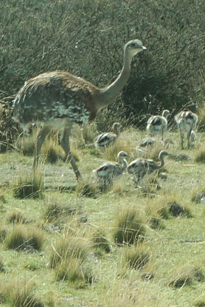
Lesser Rhea father with chicks (fathers raise the young)
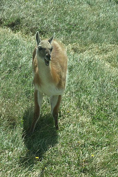
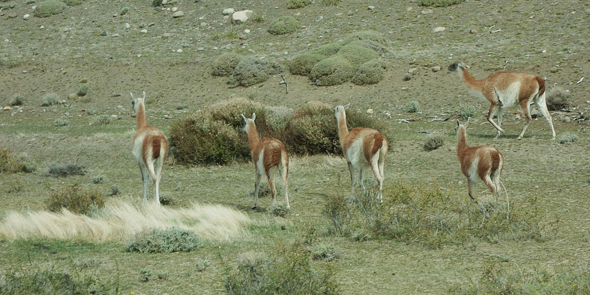
Startled guanaco
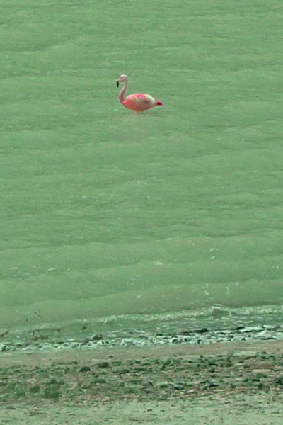
Chilean Flamingo wading in the lake
1 / 9
Dramatic view of Torres del Paine National Park
2 / 9
The valley where we stayed (our lodge is in the middle of this picture)
View showing the overall scale of the Torres del Paine National Park
Massive granite Paine Towers
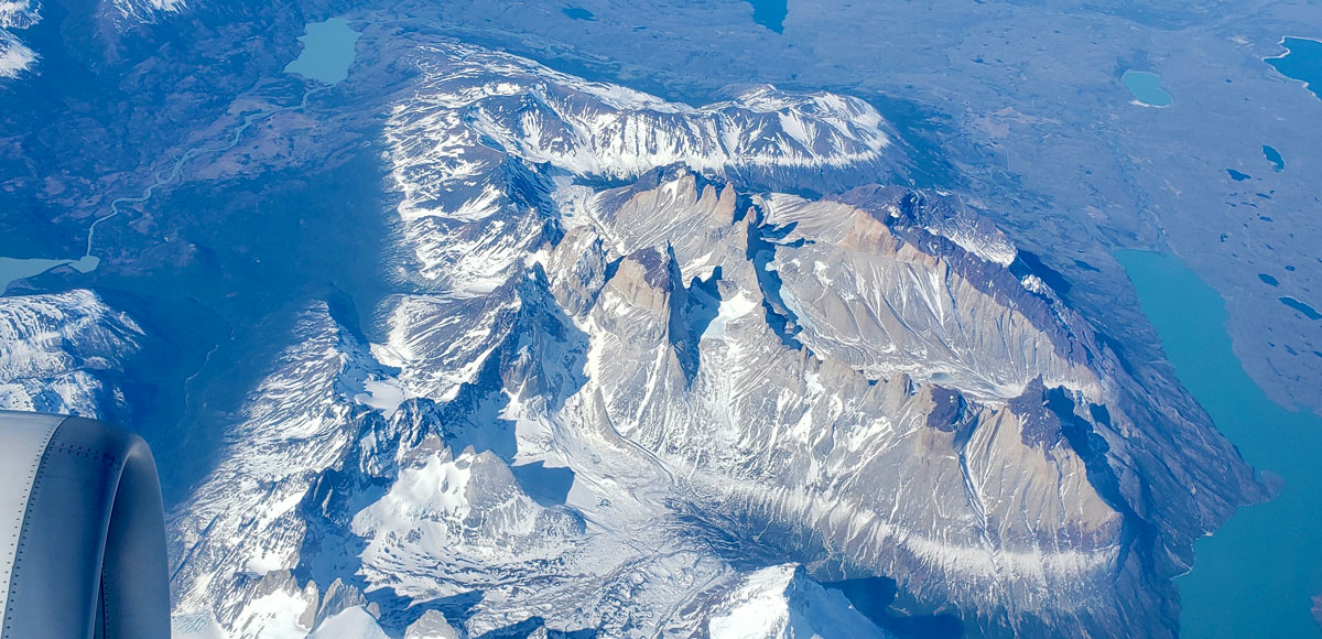
View of Torres del Paine looking south from the air (photo by Ben van der Pluijm)
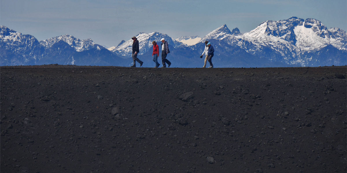
We hiked through some more of the dramatic lakes, mountains, and pristine wilderness of the park including a hike to Laguna Amarga — the region's only body of saltwater. Laguna Amarga features white salt-encrusted black sand and flamingos as well as a panoramic view of the three massive granite Paine Towers. Throughout the day, we saw some of the park's 106 species of birds and 26 species of mammals.
View of Laguna Amarga
Leaving for Chile's Lake District and Puerto Varas
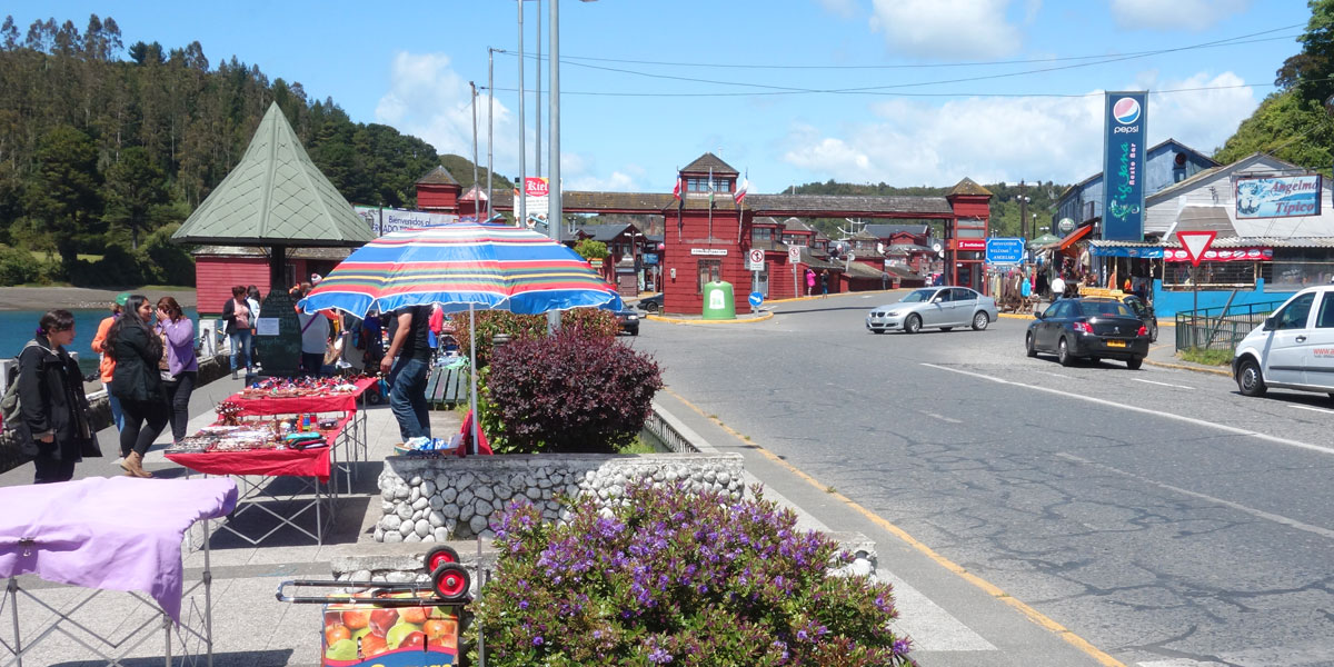
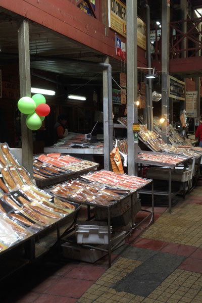
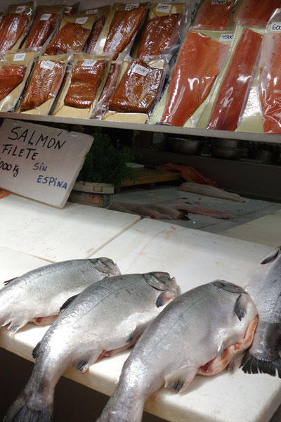
From Torres del Paine, our bus took us back to Punta Arenas to catch our flight to Puerto Montt — the gateway to Chile's Lake District. Another bus greeted our arrival to take us to Puerto Varas and our lakeside hotel. We also visited the small fishing port of Angelmo nearby which is known for its fish market and the Vicente Rosales National Park.
Flying from Puerto Arenas to Puerto Montt — the gateway to Chile's Lake District
Vicente Rosales National Park
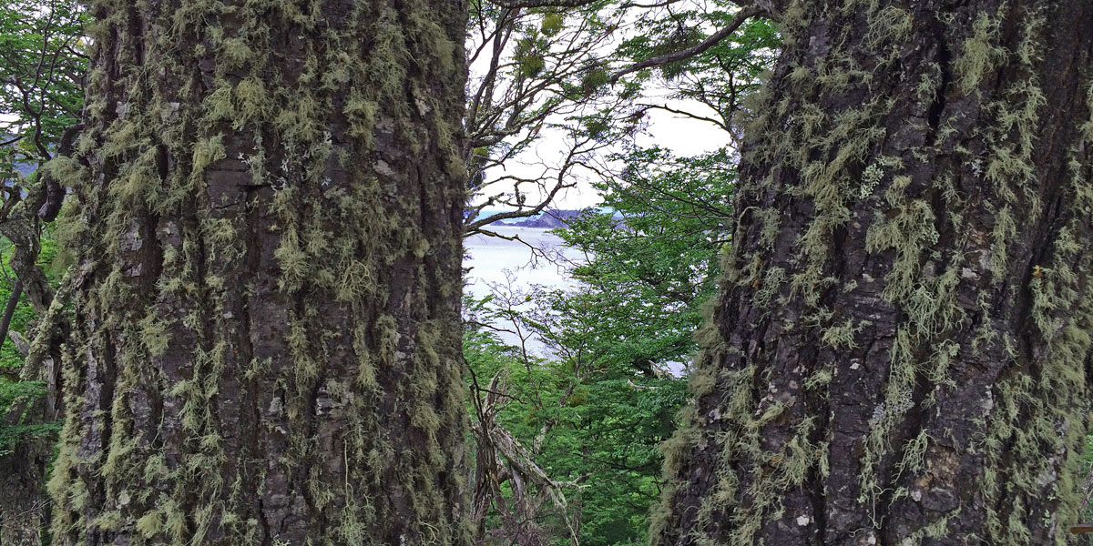
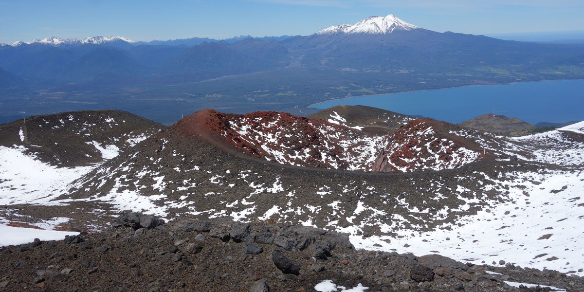
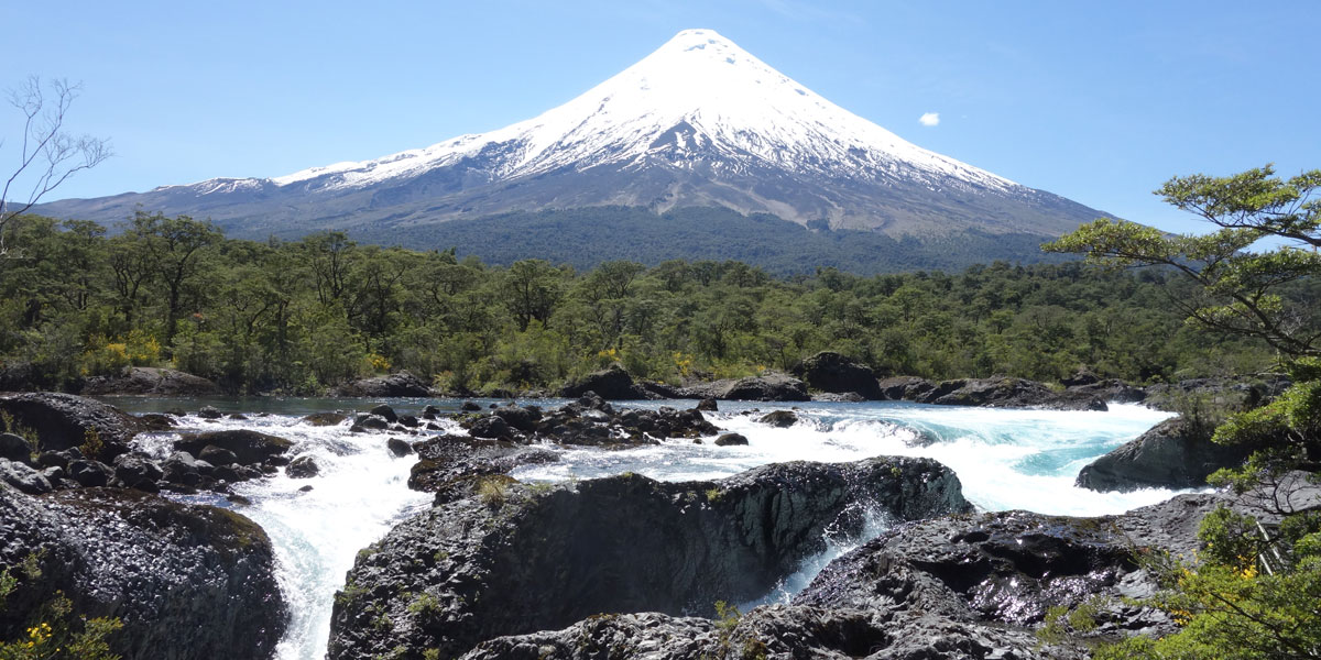
From our base in Puerto Varas, we spent a full-day in Vincente Rosales National Park. Some of the highlights in the park are the Petrohue river waterfalls, the Osorno volcano and its ski lodge, cinder cones, Lake Todos los Santos, Puntiagudo river valley, Cayutue valley, and the Tronador volcano. This diverse landscape and the dominant presence of its volcanoes, has turned this park into one of the principal destinations in the region of Los Lagos.
The Vicente Rosales National Park was created in 1926 and is the oldest park in the Chile. It has a surface area of over 620,000 acres and is situated in a zone where tectonic, glacial, and volcanic processes have shaped the Andes. The main peaks are the volcanoes Puntiagudo, Osorno, La Picada, and Tronador. Retreating glaciers and the rise of the Osorno volcano allowed for the formation of the Lake Todos los Santos, which is surrounded by steep mountains and valleys draining into Petrohue river and Reloncaví estuary. Its most important attractions are its volcanoes and mountains, great forests of native trees, and one of the most beautiful and virgin lakes in the south of Chile — the lake Todos Los Santos.
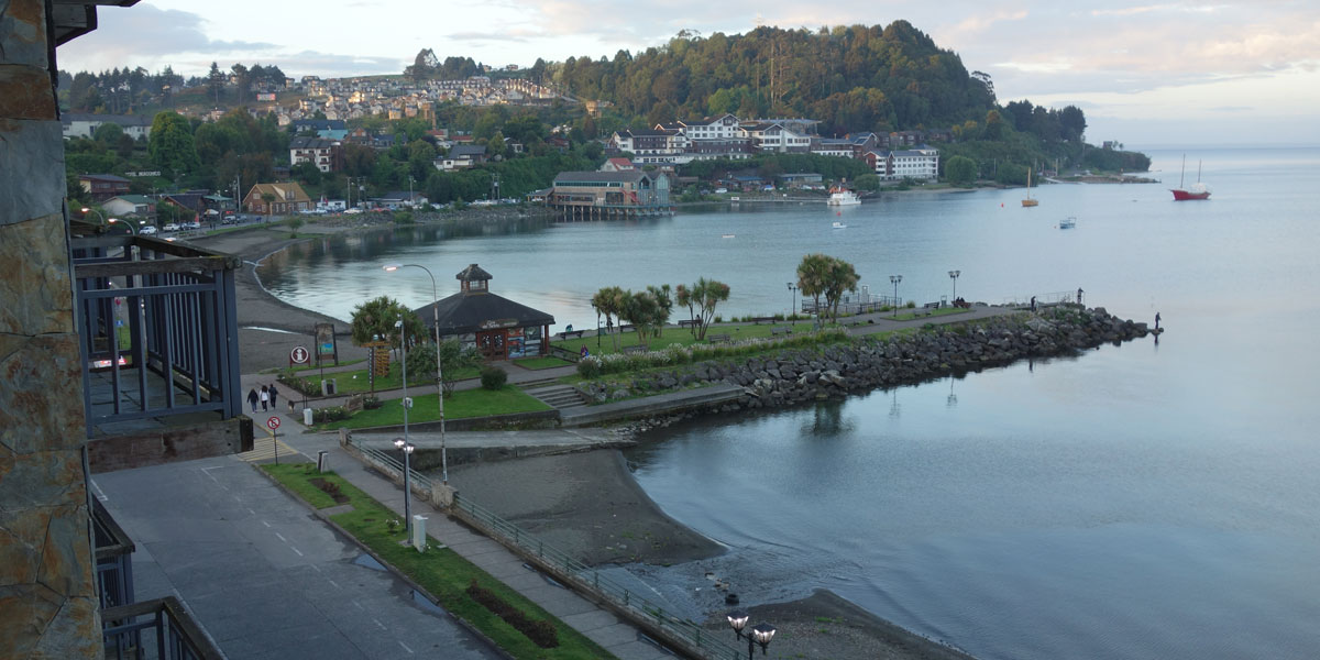
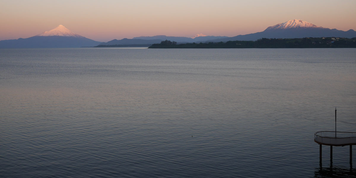
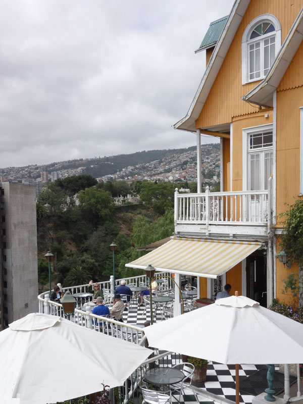
Puerto Varas is a quaint town of German heritage dating back to the mid-1800s. It sits on the southwest banks of the expansive Lake Llanquihue, which offers commanding views of snow-capped Osorno and Calbuco Volcanos; both still active. Traditional German-style architecture characterizes the town, reflecting its colonial past.
1 / 9
View from our hotel room overlooking Lake Llanquihue
2 / 9
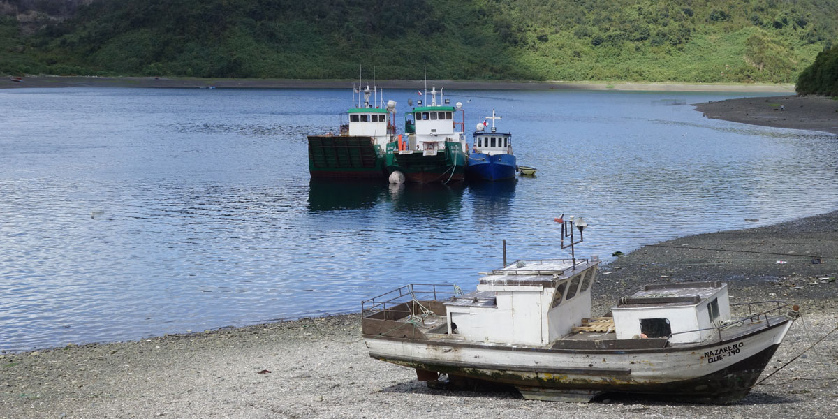
Approaching Angelmo's renowned fish market
3 / 9
Fishing boats at Angelmo
4 / 8
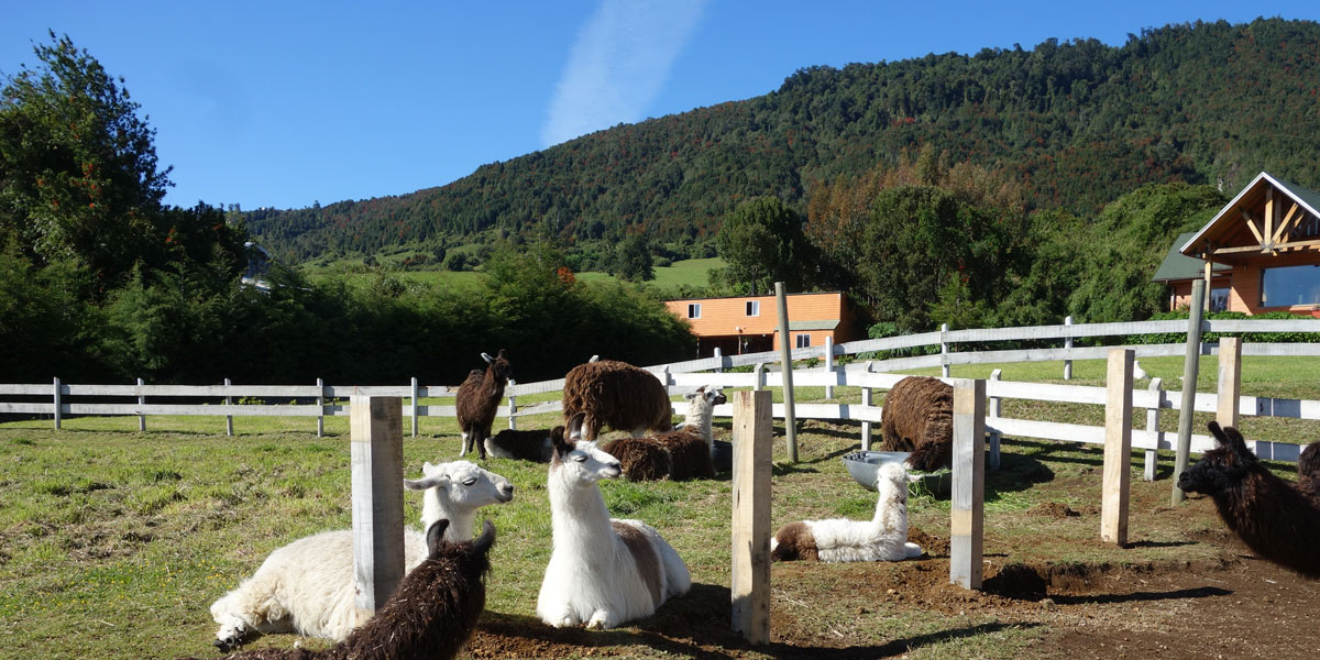
Llamas relaxing at the side of the road
5 / 8
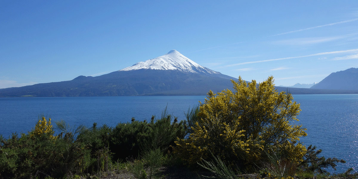
The majestic Orsano Volcano
6 / 8
Entering the Vicente Rosales National Park
7 / 9
The Petrohue Waterfalls with Orsano Volcano in he background
8 / 9
Hiking along the ridge at the Vicente Rosales National Park
9 / 9
Sunset from my hotel room over Lake Llanquihue an Orsano Volcano
Leaving Puerto Varas with the Orsano Volcano below us
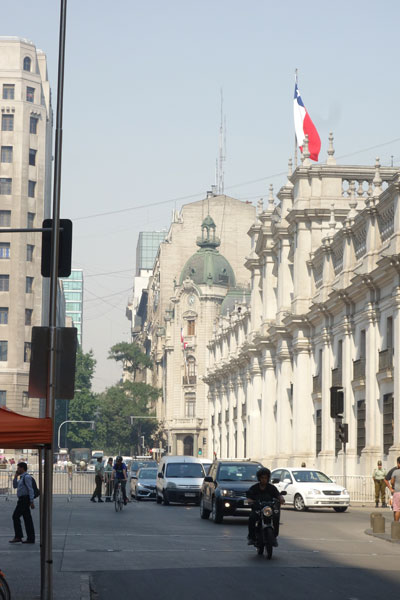
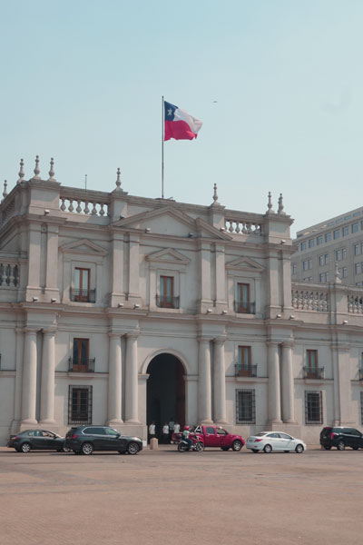
Santiago
rom Puerto Montt we flew to Santiago where we visited Santiago's traditional city center including the Plaza de Armas, Cathedral Metropolitana, La Moneda Palace, and the Parqu Forestal.
Street scene in Santiago's central Plaza de Armas
The Central Post Office building in Santiago
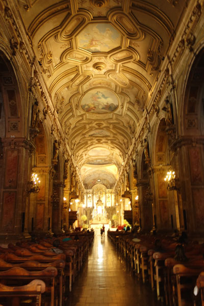
Inside the Cathedral Metropolitana in Santiago
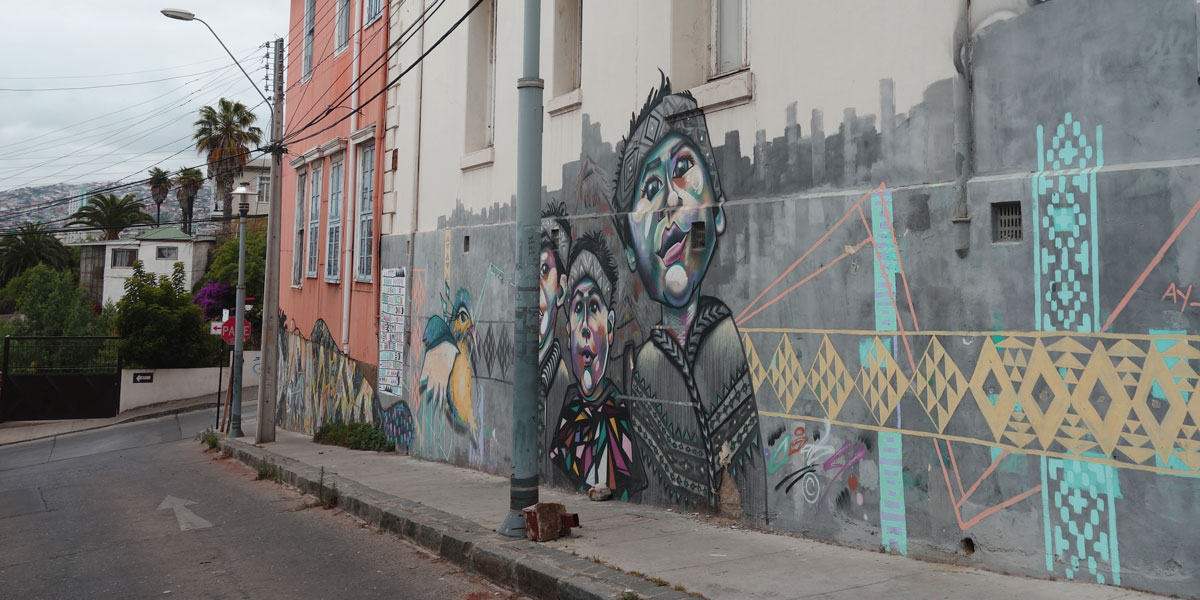
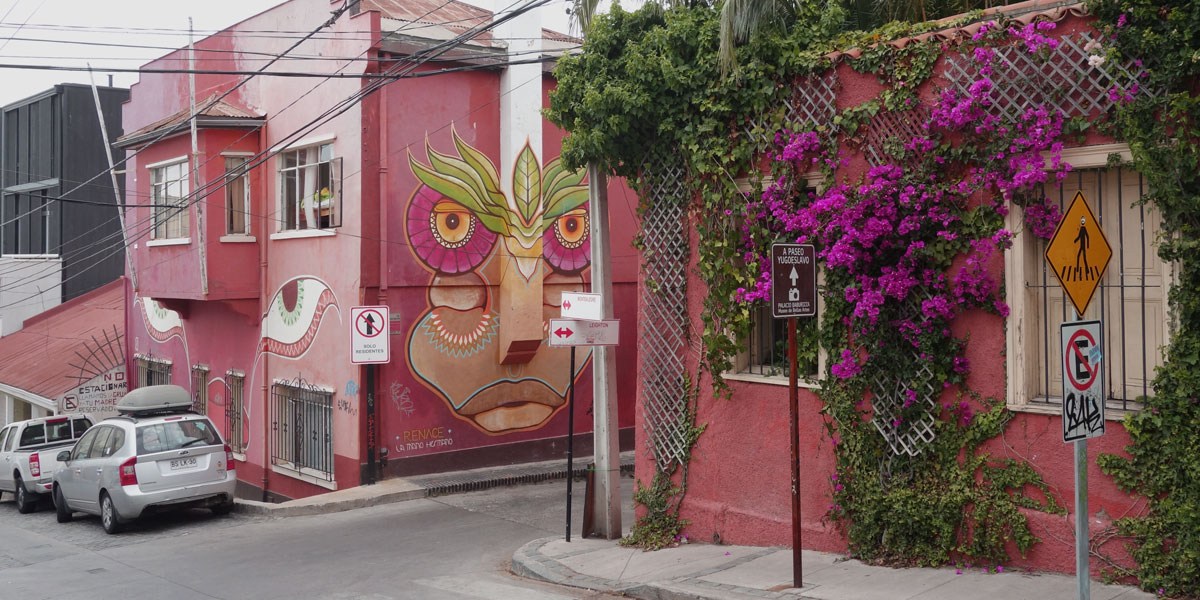
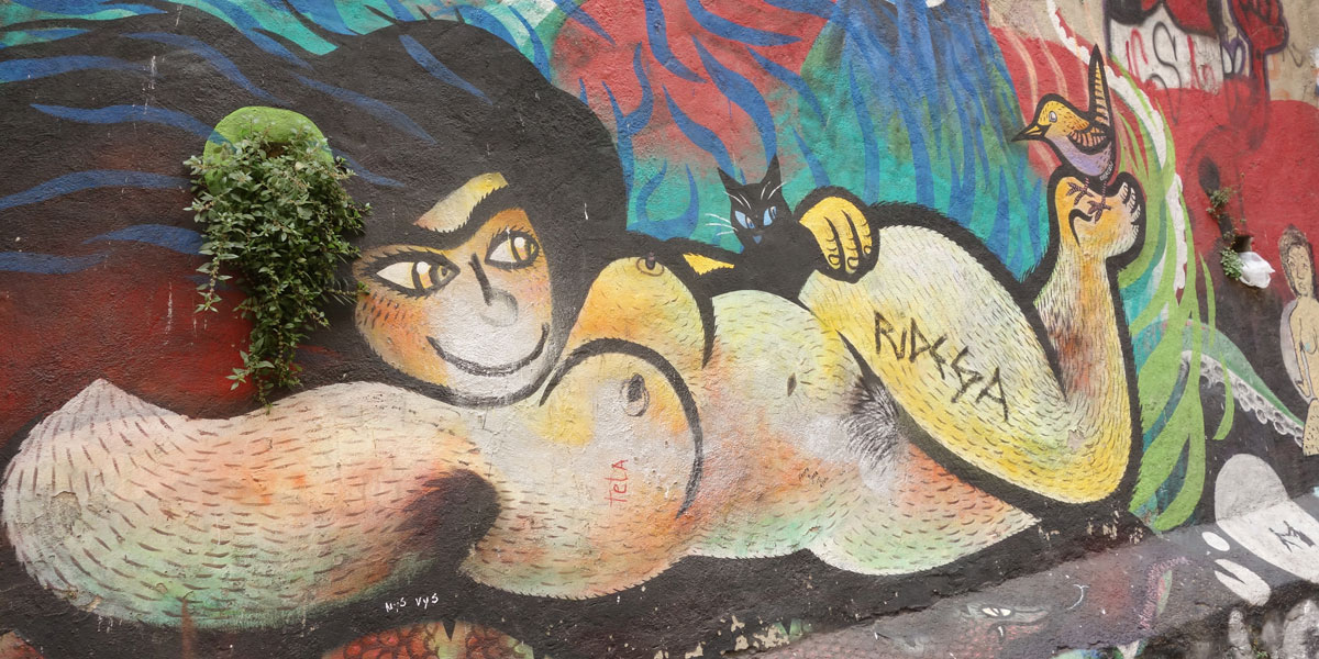
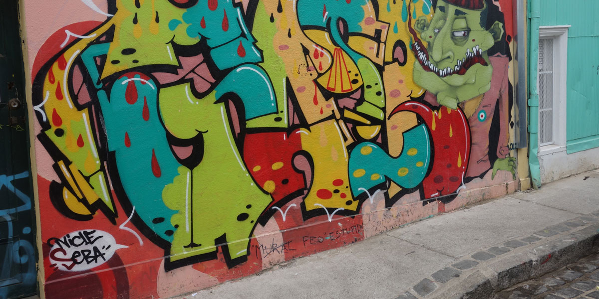
Valparaiso
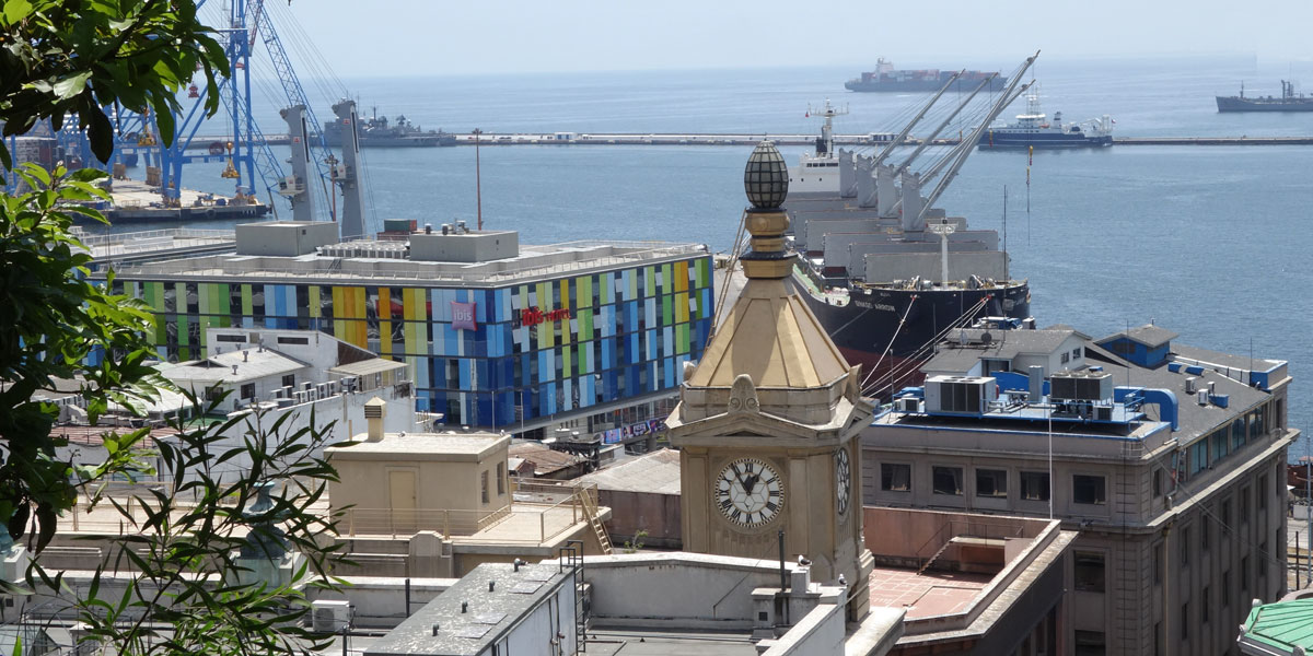
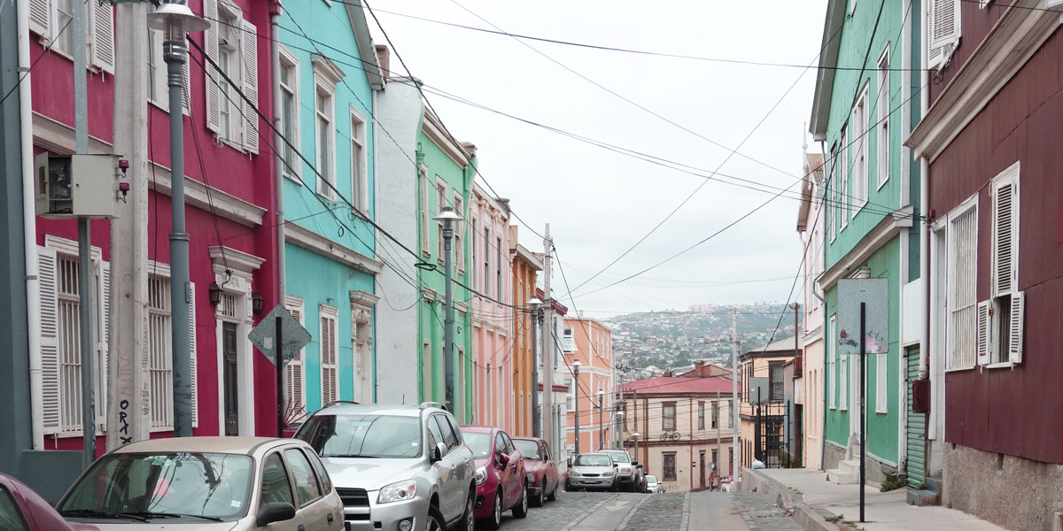
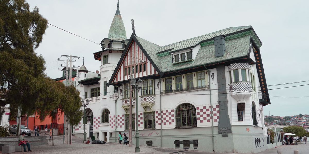
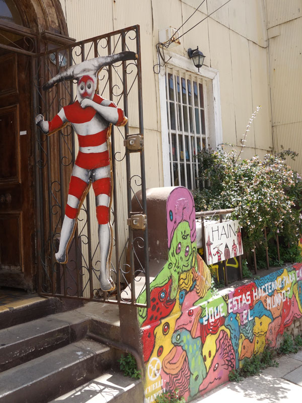
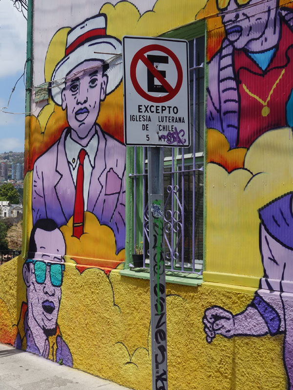
On the next day, we travelled to the old port town of Valparaiso — now a UNESCO World Heritage site. Since its founding in 1536, Valparaiso has survived earthquakes, fires, and pirate raids to become Chile's main port. We spent most of the day walking through the city's steep and narrow, winding streets with its colorful buildings and vibrant wall murals. Just about every building is painted in a unique and vibrant color. The city goes even further as residents have allowed or, in many cases, commissioned local artists to paint murals on their buildings as well. The only rules are that the owner of the building has to give permission and the mural cannot be overly offensive. Artists go around to homes, show off their ideas to the owners, and if there is a match the mural gets put up. As a result of this open minded attitude to art, Valparaiso is covered in some amazing murals ranging from incredibly small to the size of a multi-level high rise. On the way back to Santiago, we stopped at a local winery that produces Chile's Cabernet solvating and other notable reds.
Postscript. After visiting Santiago and Valparaiso, My husband and I said goodbye to our fellow travelers and departed for Easter Island the next morning. It is difficult to describe, or illustrate with our photos, the extreme natural beauty, pristine environment, and vastness of Patagonia — particularly the Torres del Paine National Park. There were no paved roads (and no camper vans) and we did not ever see a speck of litter anywhere. The water was crystal clear and it was rare to see another human on the well-maintained park trails.
 In November 2016, we travelled to Chile and Argentina to visit two of the world's last great frontiers — the majestic fjords and glaciers of Southern Patagonia (on a small ship) and the dramatic scenery of Torres del Paine National Park (hiking). Starting in Buenos Aires and ending in Santiago — plus a subsequent adventure to Easter Island — we discovered the remarkable diversity of South America.