As we ended our visit to Southern Patagonia, we decided to fly to Easter Island — a place that has baffled historians and archaeologists for decades. Chile’s Polynesian island located 2,200 miles to the west in the in the Pacific Ocean — known as Rapa Nui — is famous for its 887 monumental statues, called moai, created by the early Rapa Nui people. In 1995, it was named a UNESCO World Heritage Site, with much of the island protected within Rapa Nui National Park.
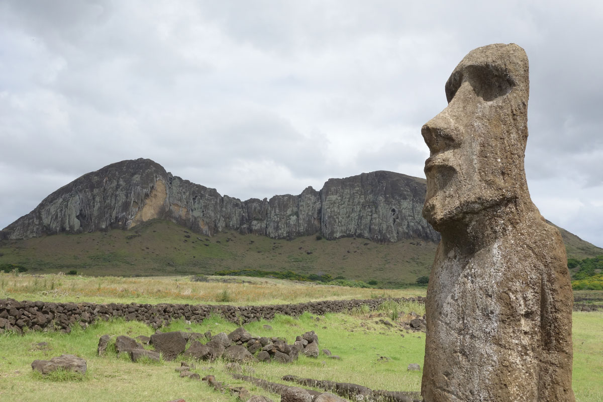
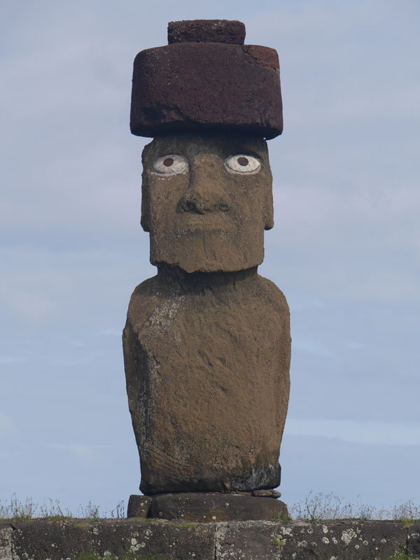
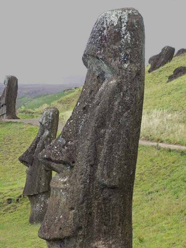
Moai or moʻai are monolithic human figures carved from rock by the Rapa Nui between the years 1250 and 1500. Almost all moai have overly large heads, which comprise three-eighths the size of the whole statue. It is believed that the moai represent the living faces of deified ancestors. Nearly half are still at Rano Raraku, the main moai quarry, but hundreds were transported from there and set on stone platforms, called ahu, around the island's perimeter. The production and transportation of the statues is considered a remarkable physical feat. The tallest moai erected, called Paro, was almost 33 feet high and weighed 80.7 tons. Although first discovered by Europeans visiting the island in 1722, many moai had fallen by the latter part of the 19th century.
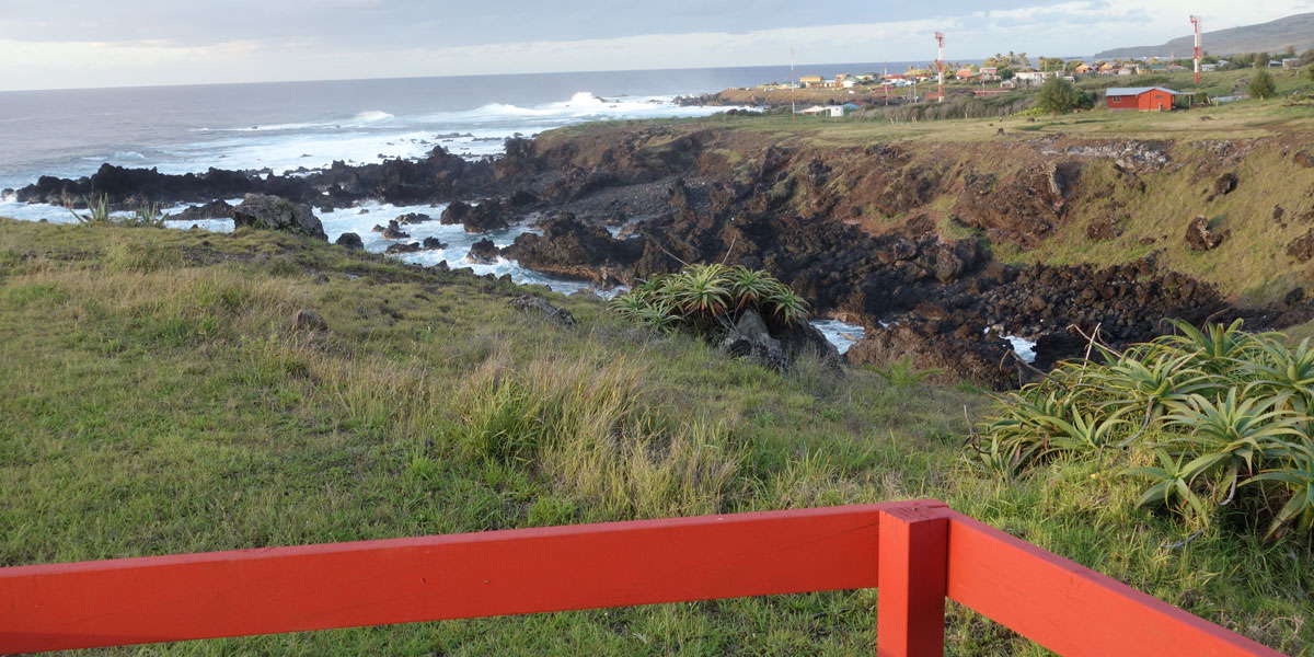
Approaching by plane after a five-hour flight from Santiago, three distinct volcano craters emerge on a triangle of green grass fringed by black coastline. Everything else — in all directions — is barren blue ocean. The island is only 14 miles long by 7 miles wide. The feel here is instantly more Polynesian than Chilean, despite Chile’s annexation of this mysterious island in 1888.
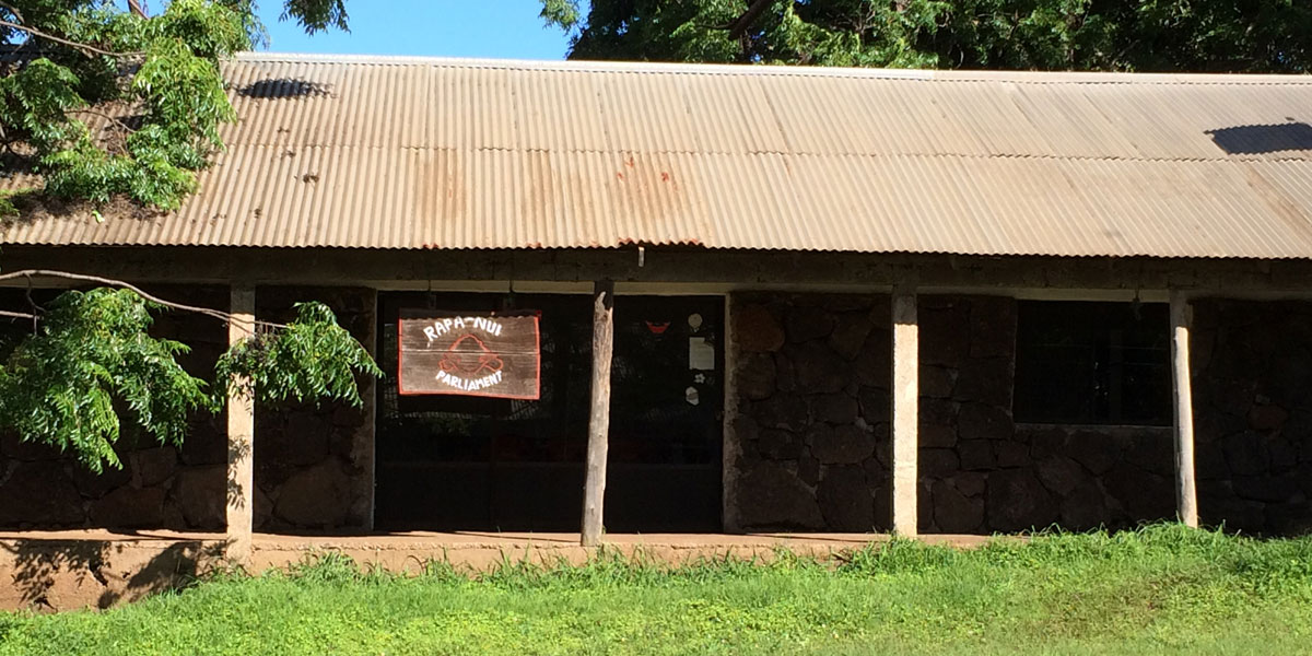
We reserved a room at the Iorana Hotel which is a short walk to the main town of Hanga Roa. The room in this family-run hotel was simple but had a porch with an outstanding view of the ocean — with crashing waves and beautiful sunsets. Since we arrived early in the morning, we decided to walked down the dirt road to the town to orient ourselves. Most of Easter Island's 3,000 people live in Hanga Roa. There is a small harbour aligned with a variety of small guest houses and restaurants, along with a post office, a tourist center, and a few government buildings. Several Chilean government departments including the Chilean Navy maintain a presence on the island.
The view from our hotel room with Hanga Roa to the north past the airport runway
Our photos are organized by the archaeological sites that we visited over our four-day stay on the island.
Tahai
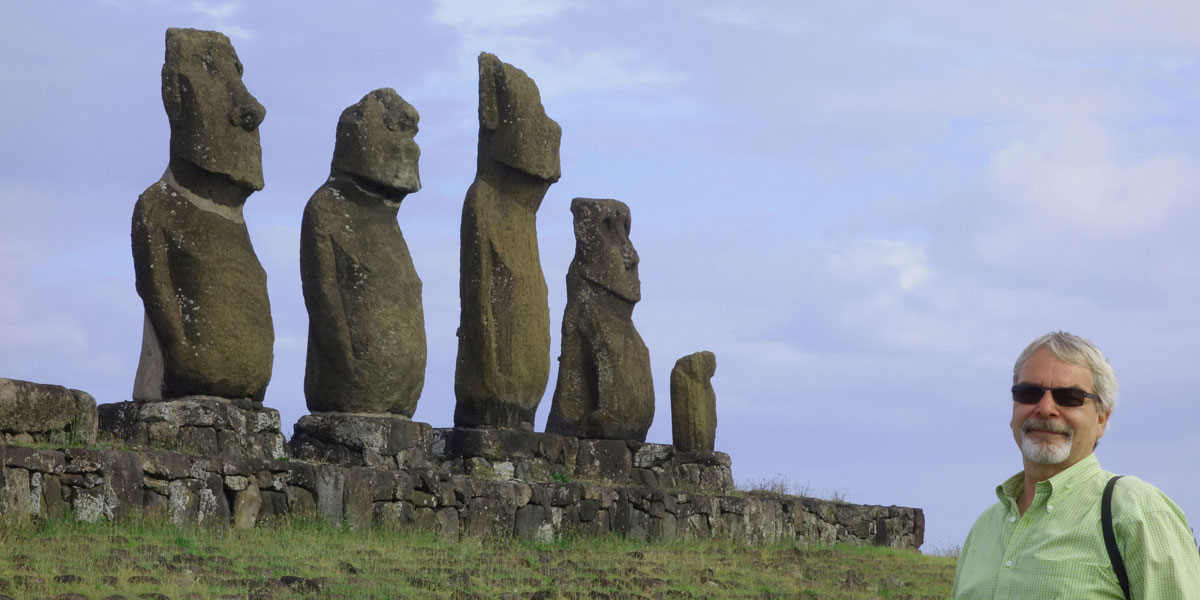
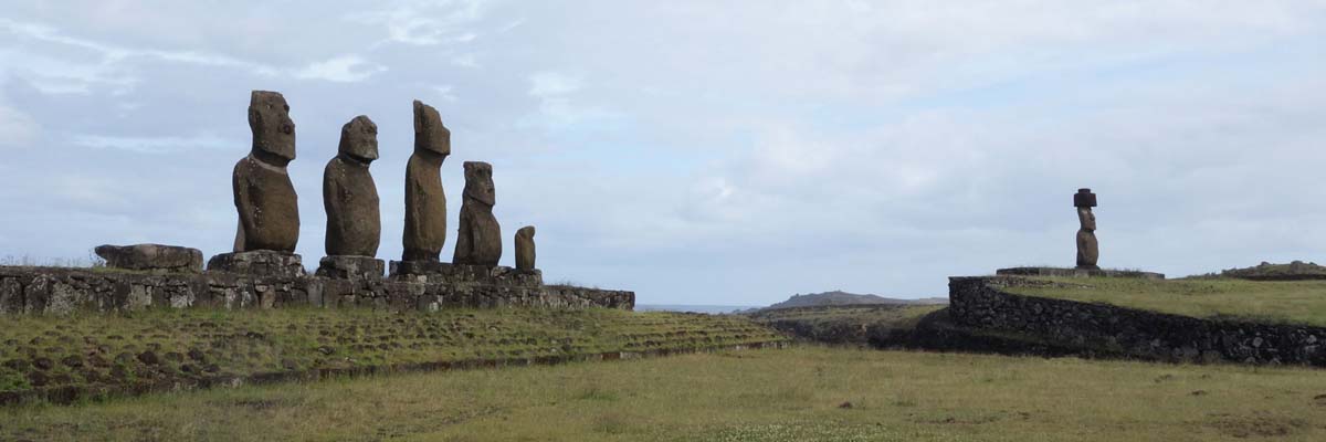
Tahai is a site with several ahus and moai statues close to Hanga Roa. Tahai has three ahus — Ahu Vai 'Uri (five moais), Ahu Tahai (one moai), and Ahu Ko Te Riku (one moai). The moai of Ahu Ko Te Riku is the only moai with eyes restored, though they are made of cement as opposed to coral.
1 / 6
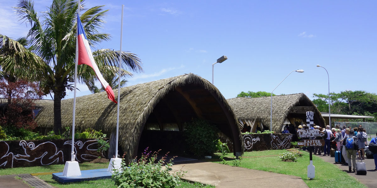
The Rapa Nui Airport
2 / 6
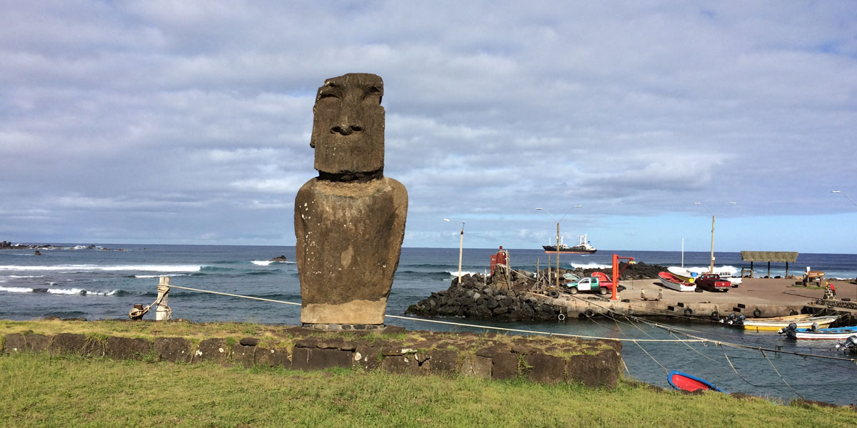
A moai proudly defending the small harbour
3 / 6
Two of the three moais at the Tahai site within walking distance to Hanga Roa
4 / 6
Peter admiring a group of five moais on a single ahu at Tahai
5 / 6
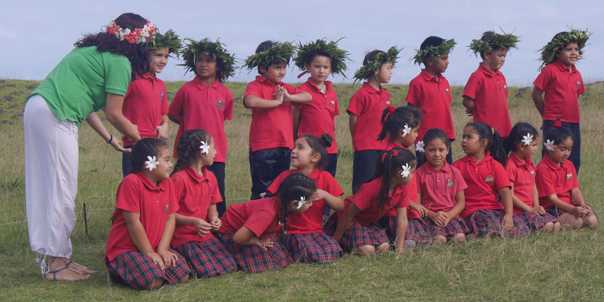
A teacher directing students in song by the harbour
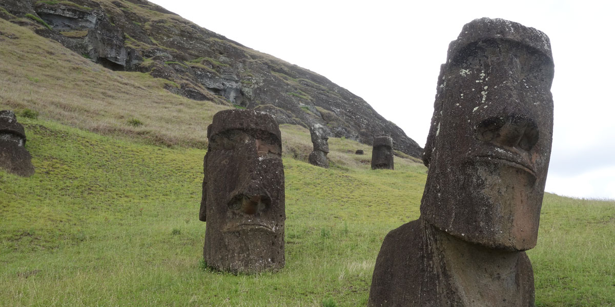
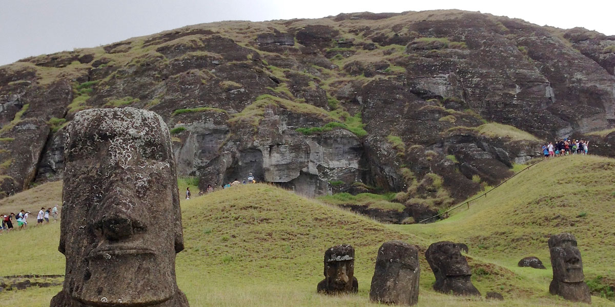
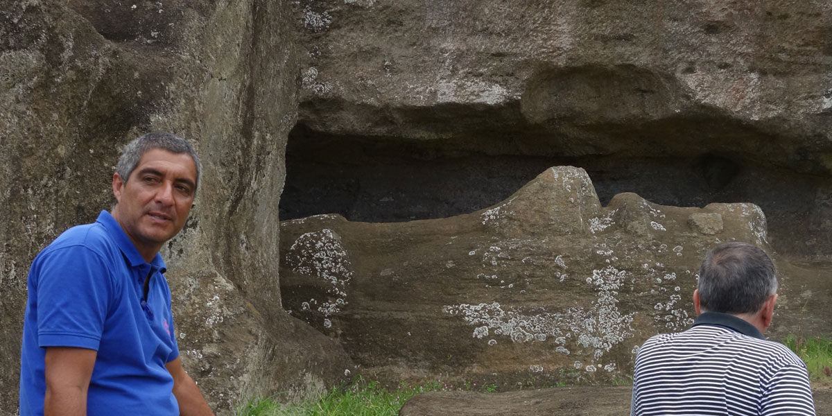
At Rano Raraku, believed to be the quarry where most of the moai were carved, roped-off pathways lead up the volcanic hillside where hundreds of heads protrude from the soil. Complete bodies lean at awkward angles, and ruined or unfinished sculptures lay on their sides. After each statue had been carved, it was carefully cut away and moved to its designated final resting place on the island, often many miles away. Today there are 397 moai in the quarry. Some are nearly completed statues almost ready for transportation; others are still in the process of being carved and not yet removed from the bedrock. Today, all of the moai at Rano Raraku remain as they were left when work at the quarry was abandoned.
View over the Rano Raraku quarry
1 / 4
Moais at Rano Raraku
2 / 4
Moais covering the hillside at Rano Raraku with people for scale
3 / 4
Our guide in front of an unfinished moai in bedrock at Rano Raraku
Most moais on the island face inland toward a settlement or village but at Aku Akivi, seven moais, of equal size and shape, stand in a line facing the ocean. They face the sunset on the spring equinox and have their backs to the sunrise on the fall equinox. This is the only spot on the island where such importance was given to astronomy and it is thought that it may have been used as a celestial observatory, making it a particularly sacred site.
View of the seven moais facing the ocean at Ahu Akivi
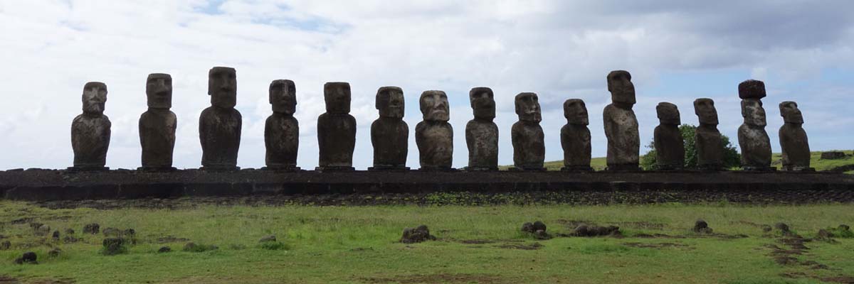
Ahu Tangariki
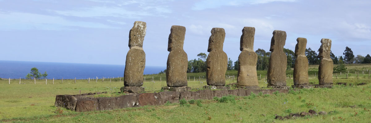
Of all the ahu on Easter Island, the most prestigious one is Ahu Tongariki, located a short distance from Anakena Beach. It is a striking row of 15 moai elevated on a platform (or ahu). This is one of the most famous Easter Island attractions as well as being an intriguing mystery. The individual characteristics of these figures are all different, ranging from tall to slim to small, to stylized, with facial characteristics that vary as much as the differences in shape and size.
View of the 15 moais at Ahu Tongariki near Anakena beach
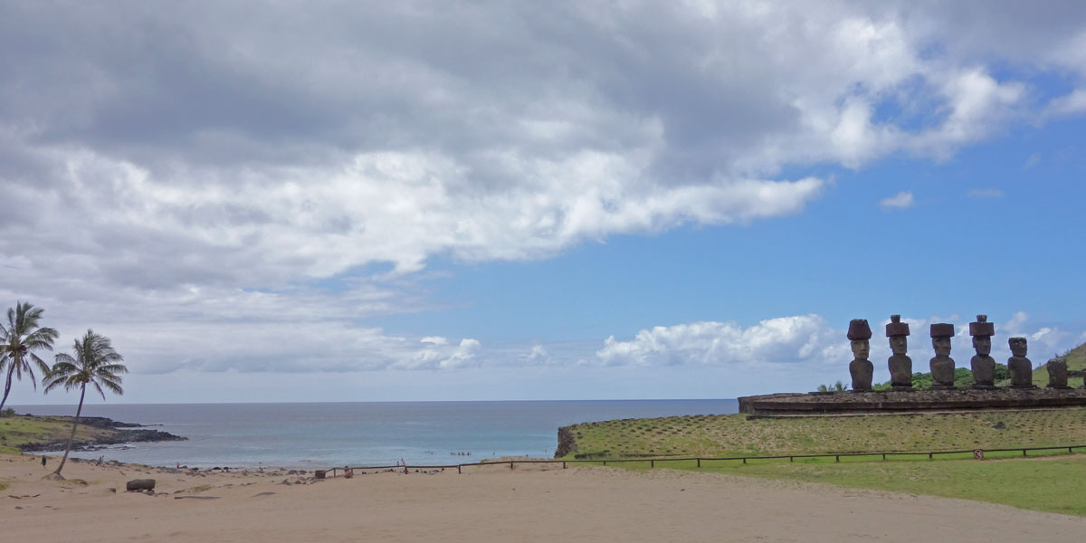
Anakena Beach
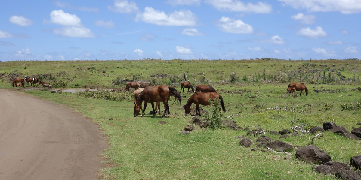
Anakena Beach is one of the few sand beaches on the island — with its white powder sand, crystalline turquoise waters, coconut palm trees, and a few wild horses. Anakena is also the site of Ahu Nau Nau.
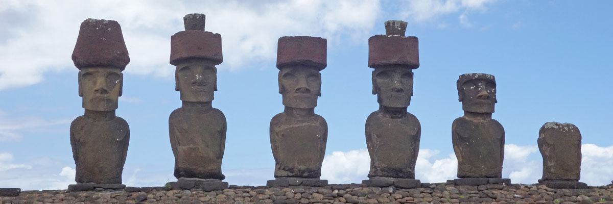
Ahu Nau Nau
Of the seven moais at Ahu Nau Nau, four are wearing red topknots. When the statues were knocked down during the clashes between the various clans of the island, they were left buried in the sand on the beach. This allowed them to be more protected from erosion — preserving a lot of detail — until they could be restored to their former positions.
View of Anakena Beach and Aha Nau Nau
View of the seven moais with topknots at Ahu Nau Nau
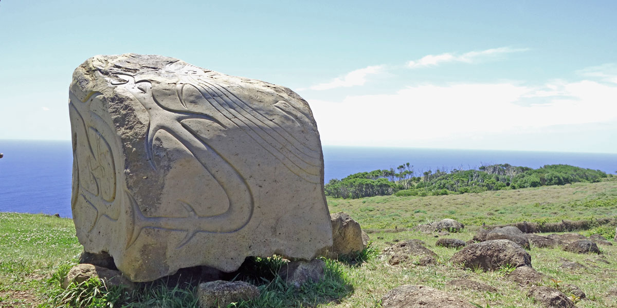
Ate Pito Kura
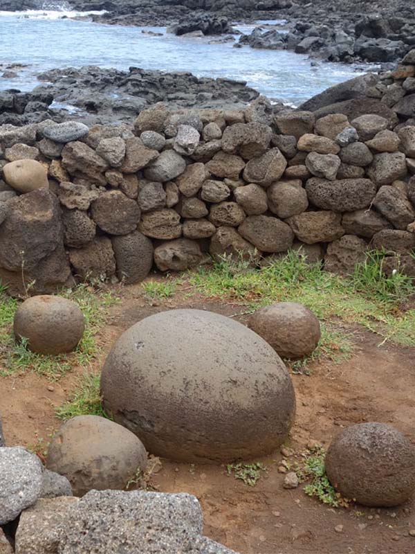
Te Pito Kura is an archaeological complex located southeast of Anakena Beach. In this ceremonial center is the moai named Paro, which is the largest moai statue (33 feet high) transported from the Rano Raraku volcano quarry and erected successfully on an ahu or platform. Next to the ahu, a few meters away, is a large ovoid shaped stone 80 centimeters in diameter. Te Pito Kura means navel of light and it is said that this rock, almost spherical and smooth, concentrates a magnetic and supernatural energy called Mana. It is also referred to as the naval of the world.
Ahu Paro — the largest moai on the island
The naval of the world at Te Pito Kura
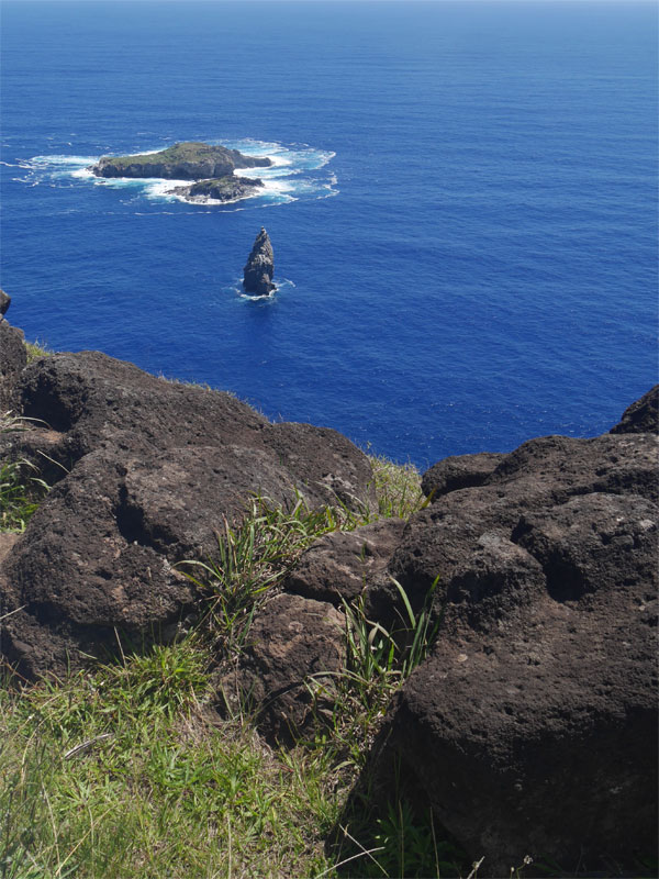
Rano Kau
There are three principal volcanoes which form the highest points of Rapa Nui, but only one — Rano Kau — can be comfortably reached without a guide. Rano Kau is an extinct volcano that rises 1,063 feet above sea level to form the southwestern cape of the island. Inside is a huge crater of approximately one mile in diameter and a freshwater lagoon, which is 33 feet deep. Over the years, erosion has caused parts of the crater wall to merge with the high sea cliffs. Rano Kau is home to a small museum and visitor center located in the restored ceremonial village of Orongo.
View of the Rano Kau volcano
Orango
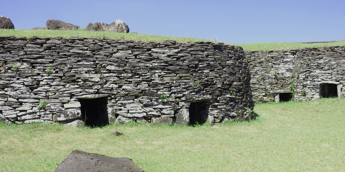
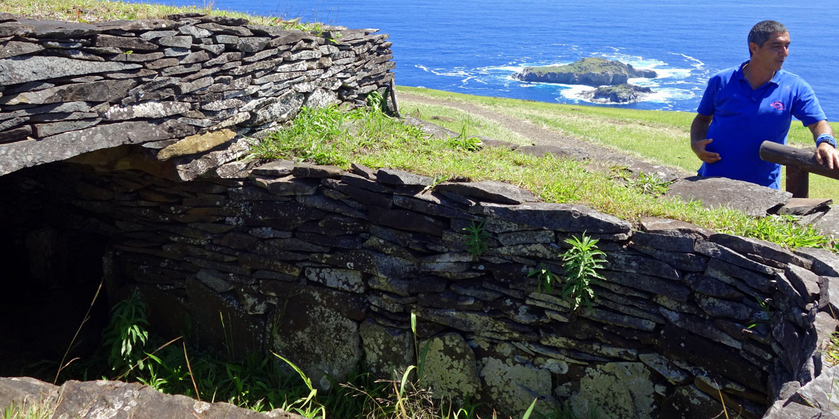
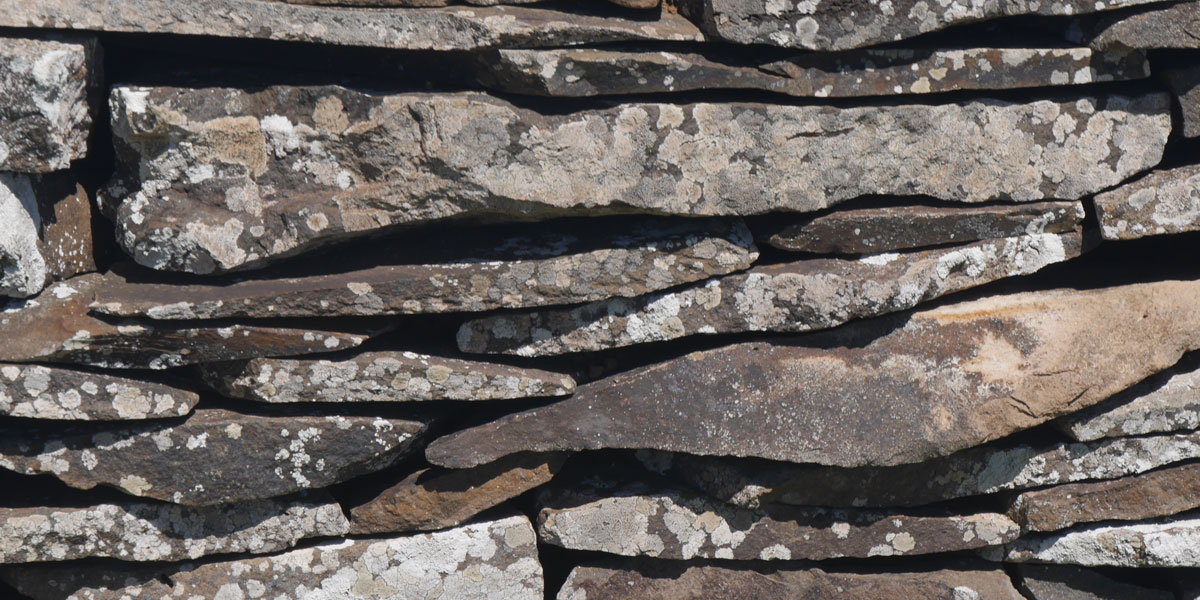
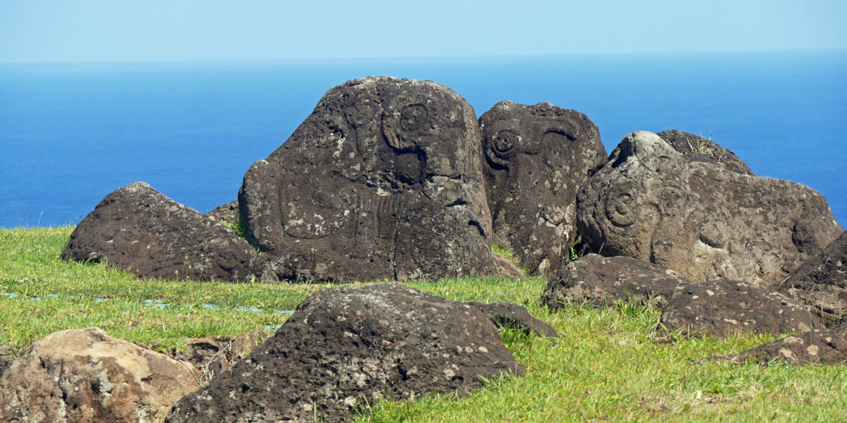
The ceremonial village of Orongo is one of the most interesting and spectacular archaeological sites on Easter Island. Orongo is located on the southwestern part of Rano Kau volcano, in a narrow strip between the edge of the crater and the cliff, which descends almost perpendicular into the sea. The village was inhabited seasonally by the chiefs and main characters of the ancient tribes. The low-level traditional houses are turf-covered, windowless, round-walled buildings with even lower doors. Orango is also the home of the ancient Birdman ritual that still inspires a competition at the annual Tapati Rapa Nui festival.
Each year, contestants were selected as competitors for the title of Birdman. Each contestant would then sponsor a representative of their choosing who would be challenged to scale the dangerous face of the Rano Kau cliff, swim through shark-infested waters to the small island of Motu Nui, and then wait until the Sooty tern seabirds nested and produced an egg. The first person to find an egg and swim back with it to Orongo and climb the cliffs with the egg still intact was proclaimed the champion. In turn, the sponsor (but not the one who did all of the work) would be crowned as the Birdman, or Tangata-Manu, the headman of the island. The last race took place in 1866.
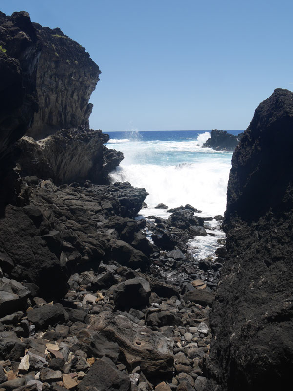
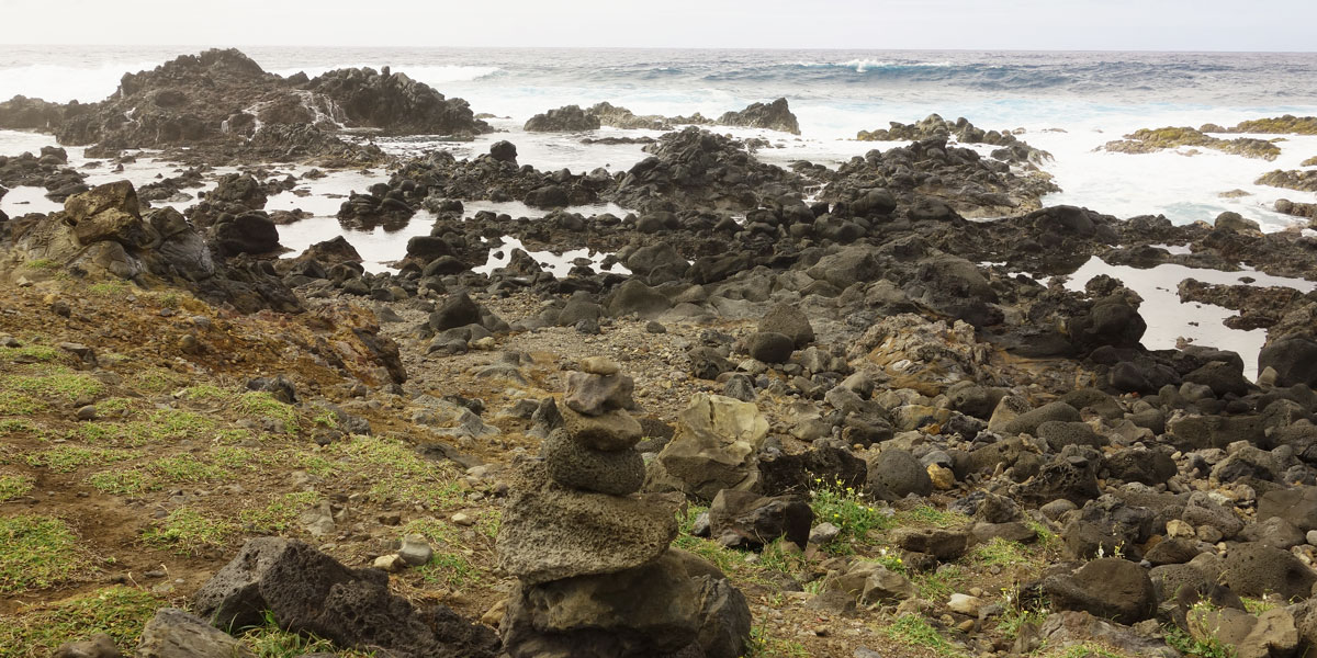
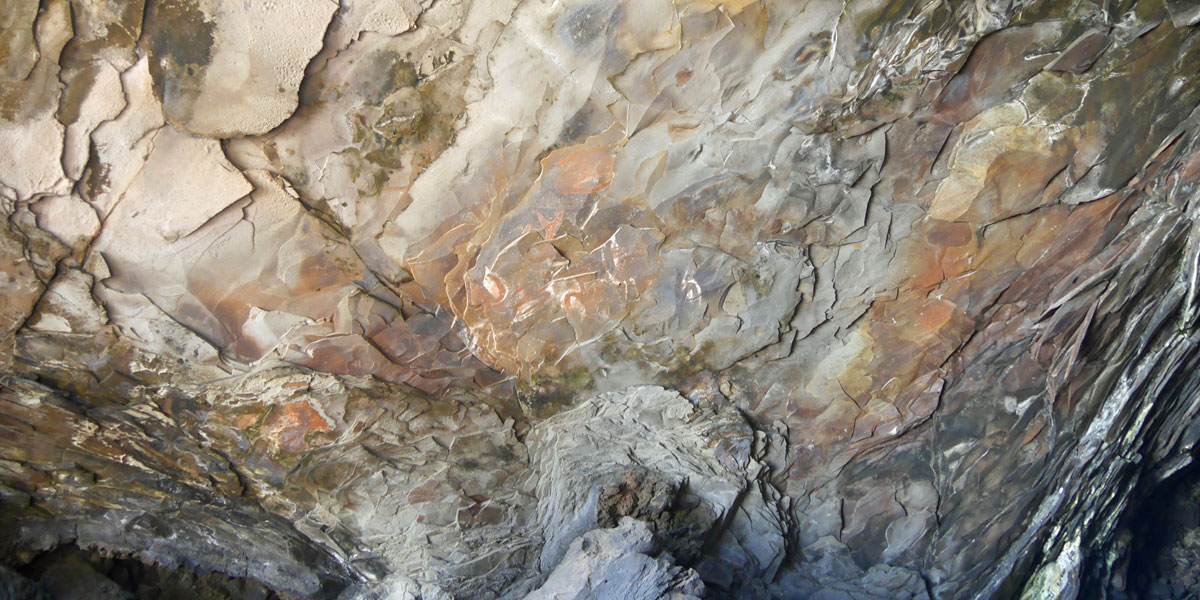
Ana Kai Tangata
We also hiked to the cavern at Ana Kai Tangata which is a sea cave that contains rock art of terns on its ceiling. The cave opens up directly to the incoming surf and is one of the few caves that is accessible to tourists.
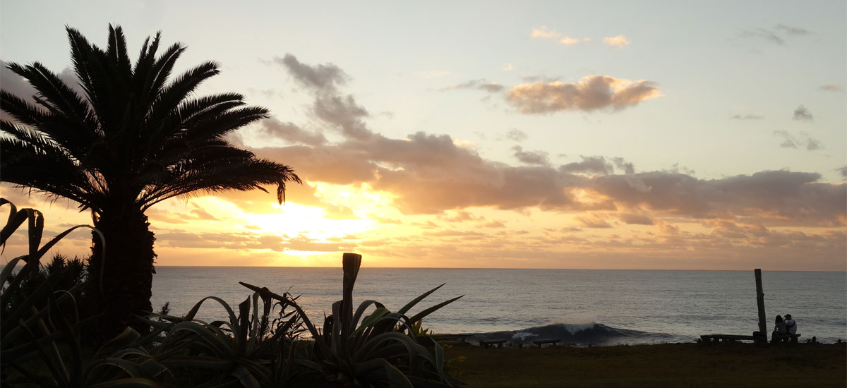
Sunset from our hotel room with the sound a crashing waves
Postscript. We arrived at the Hanga Roa airport from Santiago in a new Boeing Dreamliner — one of the most high-tech aircraft operated by a commercial airline. LATAM was an early adopter of the 787. Our first impression — it looked really sleek with slender wings and huge engines. The interior and lighting were high design with large windows and electronic window blinds. Taking off is thrilling, and flying is noticeably more relaxing — a lot less of a vacuum cleaner sound and more of a soothing rush appropriate to the speed.
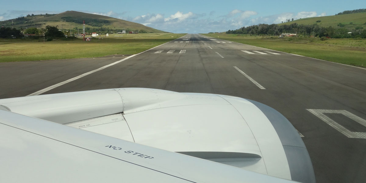
We were surprised at the size and quality of the runway on Easter Island. Later we learned that it was funded by NASA in 1987 to enable the airport to serve as an emergency landing field for future space shuttle missions launched into polar orbits from Vandenberg Air Force Base in California — which never happened.
Ironically, we were surprised at how primitive and undeveloped the island was — starting with the thatched-roof Mataveri Airport close to the main town of Hanga Roa. The only tourist shop in town had a few postcards and a choice of two T-shirt designs but nothing larger than small. We neglected to heed the comments on Trip Advisor from previous visitors warning us to bring some snacks. There was no food to be found except for at restaurants during meal times. Actually, although we found this a little bit annoying, it was really a delightful surprise.
 We reserved a room at the Iorana Hotel which is a short walk to the main town of Hanga Roa. The room in this family-run hotel was simple but had a porch with an outstanding view of the ocean — with crashing waves and beautiful sunsets. Since we arrived early in the morning, we decided to walked down the dirt road to the town to orient ourselves. Most of Easter Island's 3,000 people live in Hanga Roa. There is a small harbour aligned with a variety of small guest houses and restaurants, along with a post office, a tourist center, and a few government buildings. Several Chilean government departments including the Chilean Navy maintain a presence on the island.